London Underground Tube Map
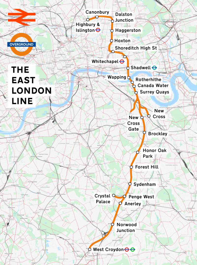
East London Line
Home > Maps of England > East London Line Map
The East London Line was a line of the London Underground, coloured orange on the Tube map. It ran north to south through the East End and Docklands areas of London, entirely in Travelcard Zone 2. It closed on 22 December 2007 for construction work, replaced by bus services.
As part of Transport for London's £10 billion investment programme, the "East London Line" is being extended. The new extended line will open in 2010, as the East London Railway, and as part of the London Overground network. The line will change from a minor stub to a key transport artery: an orbital railway linking London's suburbs.
Opened in 1869 as the East London Railway, it runs under the Thames through the Thames Tunnel, which was the oldest part of the Underground's infrastructure. The line was originally operated jointly by six different railway companies (later reduced to two) and became part of the London Underground in 1933. Of the eight stations, four are below ground.
From Wikipedia, the free encyclopedia
This file is licensed under the Creative Commons Attribution-Share Alike 3.0 Unported license.
London Underground Overground DLR Crossrail Map