English Channel Maps
Home > Maps of England > English Channel Maps
Welcome to our English Channel map page. The map of the English Channel that is located below is provided by Google Maps. You can "grab" the electronic map and move it around to re-center the map. You can change between standard map view and satellite map view by clicking the small square on the bottom left-hand corner of the map. Satellite map view utilises orbiting satellite and / or aerial high-resolution photography to display images of the map location to street level detail (really quite amazing). Standard map view shows a traditional street map (also known as a road map). You can use the zoom buttons on the bottom right-hand side of the map to zoom in or out to street level detail. We have digital online maps for most towns and cities on the Maps of England page. We also have a good collection of old school printable maps on the Maps of England page.
I hope you like the Portsmouth, England street map / road map situated above.
If you like our website, please consider adding a link to the site. These links help to build website traffic and they are considered a vote of confidence for a site.
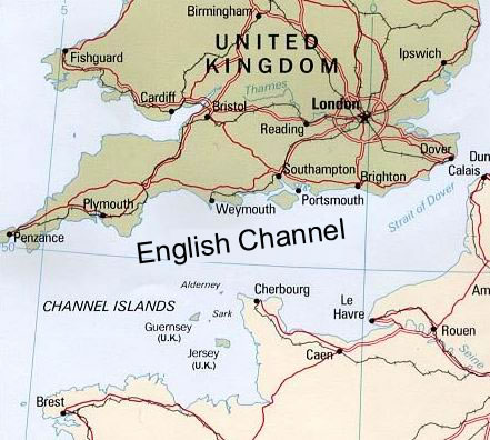
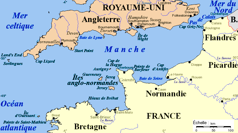
The English Channel (French: La Manche, "the sleeve") is an arm of the Atlantic Ocean that separates England from northern France, and joins the North Sea to the Atlantic. It is about 560 km (350 mi) long and varies in width from 240 km (150 mi) at its widest, to only 34 km (21 mi) in the Strait of Dover. It is the smallest of the shallow seas around the continental shelf of Europe, covering an area of some 75,000 km2 (29,000 sq mi).
An English Channel Map