Maps of Cumbria England
Home > Maps of England > Cumbria Maps
Welcome to our Cumbria map page. The map of Cumbria England that is located below is provided by Google Maps. You can "grab" the electronic map and move it around to re-center the map. You can change between standard map view and satellite map view by clicking the small square on the bottom left-hand corner of the map. Satellite map view utilises orbiting satellite and / or aerial high-resolution photography to display images of the map location to street level detail (really quite amazing). Standard map view shows a traditional street map (also known as a road map). You can use the zoom buttons on the bottom right-hand side of the map to zoom in or out to street level detail. We have digital online maps for most towns and cities on the Maps of England page. We also have a good collection of old school printable maps on the Maps of England page.
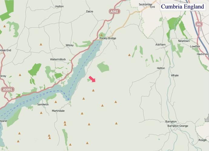
A map of Cumbria, England
Cumbria Maps
I hope you like the Cumbria County, England street map / road map situated above.
If you like our website, please consider adding a link to the site. These links help to build website traffic and they are considered a vote of confidence for a site.
Cumbria
Cumbria is a ceremonial and non-metropolitan county in North West England. The county and Cumbria County Council, its local government, came into existence in 1974 after the passage of the Local Government Act 1972. Cumbria's county town is Carlisle, in the north of the county. The only other major urban area is Barrow-in-Furness on the south-western tip of the county.
The county of Cumbria consists of six districts (Allerdale, Barrow-in-Furness, Carlisle, Copeland, Eden and South Lakeland) and, in 2019, had a population of just over 500,000 people. Cumbria is one of the most sparsely populated counties in England, with 73.4 people per km2 (190/sq mi).
Cumbria is the third largest county in England by area. It is bounded to the north-east by Northumberland, the east by County Durham, the south-east by North Yorkshire, the south by Lancashire, the west by the Irish Sea, the north-west by the Scottish council areas of Dumfries and Galloway, and the north by Scottish Borders.
Cumbria is predominantly rural and contains the Lake District National Park, a UNESCO World Heritage Site considered one of England's finest areas of natural beauty, serving as inspiration for artists, writers, and musicians. A large area of the south-east of the county is within the Yorkshire Dales National Park, while the east of the county fringes the North Pennines AONB. Much of Cumbria is mountainous and it contains every peak in England over 3,000 feet (910 m) above sea level, with the top of Scafell Pike at 3,209 feet (978 m) being the highest point in England. An upland, coastal and rural area, Cumbria's history is characterised by invasions, migration and settlement, as well as battles and skirmishes between the English and the Scots. Notable historic sites in Cumbria include Carlisle Castle, Furness Abbey, Hardknott Roman Fort, Brough Castle and Hadrian's Wall (also a World Heritage Site).
From Wikipedia, the free encyclopedia
"© OpenStreetMap contributors, CC BY-SA".
Districts of Cumbria
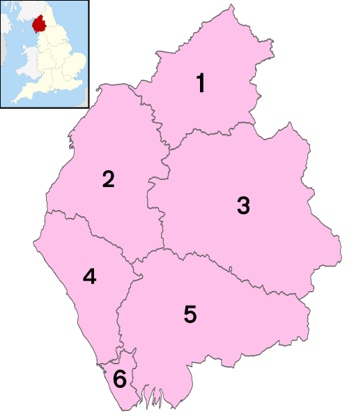
1 - City of Carlisle
2 - Allerdale
3 - Eden
4 - Copeland
5 - South Lakeland
6 - Barrow-in-Furness
Music


