Map England
Explore England with an interactive map featuring Street View, satellite and terrain views. Our location pages across all 47 English counties are real-time information hubs — built for travel planning, research and emergencies, including storms, flooding and severe weather events.
Interactive Map of England
Map search is available for a limited number of queries per session to manage costs. Be specific — search precisely for best results.
| Country | England |
| Part of | United Kingdom |
| Capital | London |
| Largest City | London |
| Counties | 47 |
| Language | English |
| Latitude | 52.3555°N |
| Longitude | 1.1743°W |
| Population | ~56,500,000 |
| Area | 130,279 km² |
| Timezone | GMT / BST (UTC+0 / UTC+1) |
| Currency | Pound Sterling (GBP) |
About England
Undulating hills, like the gentle swells of a slumbering giant, define much of England's verdant heart, from the rugged, mist-shrouded fells of the Lake District, where Wordsworth once wandered, to the chalky spine of the South Downs, their contours softened by centuries of sheep's tread. Mighty rivers, the Thames, the Severn, the Trent, carve their patient paths across the land, their banks often adorned with ancient market towns and stately homes. The coastline, a dramatic tapestry of sheer cliffs and sandy bays, from the wild shores of Cornwall to the chalky ramparts of Dover, whispers tales of invasion and exploration, a constant reminder of England's island soul. This varied terrain, shaped by glacial forces and patient erosion, possesses a quiet, enduring beauty that has inspired countless generations.
Echoes of Roman legions still resonate in the foundations of cities like Bath and Chester, their straight roads and tessellated floors a testament to an ancient occupation. Following this, the thunder of Norman hooves at Hastings heralded an era of profound change, its influence etched into castle keeps and the very language we speak. Tudor monarchs, with their intricate courts and turbulent religious shifts, forged a nation's identity, while the Stuart period witnessed civil war and the Restoration's grand artistic flourish. Georgian elegance then graced the squares of Bath and the terraces of London, before the relentless march of the Industrial Revolution, with its clatter of looms and smoke-stained skies, irrevocably altered the nation's physical and social fabric.
Agriculture, though diminished in its pre-eminence, still colours the rural landscape, its fields yielding harvests of wheat, barley, and root vegetables, tended by generations of farming families. Manufacturing, once the engine of empire, has transformed, with advanced engineering and precision manufacturing taking root in the industrial heartlands of the Midlands and the North. London, a global nexus of finance, its skyscrapers a testament to its economic might, alongside vibrant regional hubs like Manchester and Bristol, now drive the nation's economy through sophisticated financial services and burgeoning technology sectors. This intricate economic web, balancing tradition with innovation, sustains England's place on the world stage.
Literary giants, from Shakespeare's soaring verse to Austen's keen social observation, have woven narratives that define English sensibility, their words echoed in the hallowed halls of Oxford and Cambridge. Musical genius, from Purcell's operatic grandeur to the Beatles' revolutionary harmonies, has resonated across continents, while the theatrical tradition, nurtured in the West End and provincial playhouses, continues to captivate audiences. The BBC, a beacon of public service broadcasting, disseminates culture and information with unparalleled reach, and the passion for sport, particularly cricket and football, unites communities across the nation, all contributing to a vibrant and enduring cultural tapestry.
A mosaic of peoples, drawn from every corner of the globe, now forms the modern English society, their traditions and perspectives enriching the national character, a far cry from earlier homogenous notions. Deep-rooted regional identities, evident in the distinct dialects and customs of Yorkshire, Cornwall, and the Scottish Borders, persist with pride and affection, fostering a sense of belonging. Age-old traditions, from the village fête to the Boxing Day hunt, continue to mark the turning of the seasons and the rhythm of community life, while a certain understated resilience and a dry wit often characterise the English way of life, a blend of stoicism and gentle humour.
English County Maps by Region
East Midlands
East of England
London
North East England
North West England
South East England
South West England
West Midlands
Yorkshire and the Humber
All English Counties (A–Z)
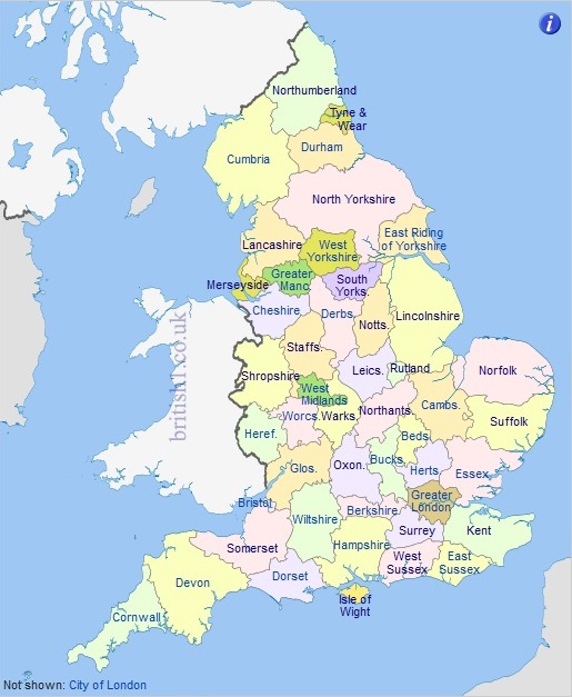
A Large Detailed UK Counties Map for England
From Wikipedia, the free encyclopedia
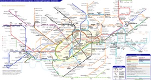
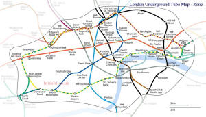
London Underground Tube Maps
London Underground Overground DLR Crossrail Map
London Underground Tube Map - Zone 1
London Underground Tube Lines
Historic & Specialist Maps of England
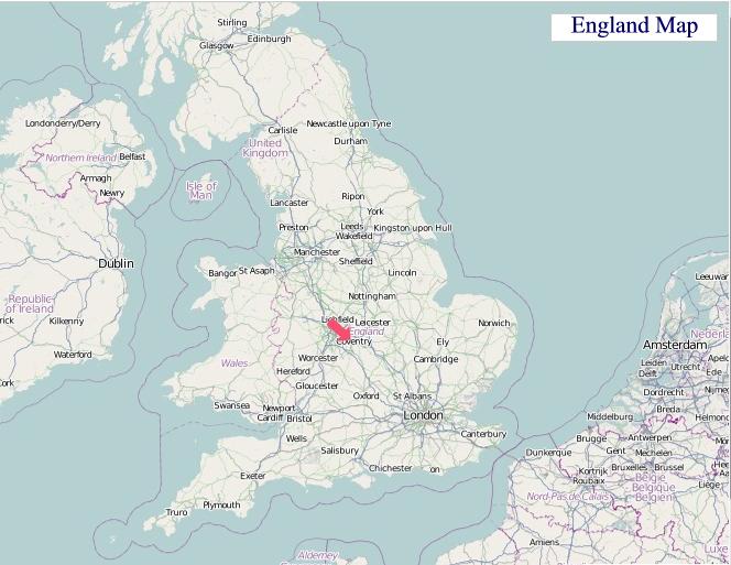
Map of England, United Kingdom
© OpenStreetMap contributors, CC BY-SA.
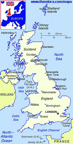
Map of England
Maps courtesy of www.theodora.com/maps used with permission.
Latest News: England
Loading news…
UK News
Loading news…
World News
Loading news…
Explore England — Interactive Maps, Weather & Local Information
This page provides an interactive Google map of England with Street View, satellite and terrain views. Each of our 33,000+ English location map pages is a self-contained information hub updated in real time. Precise GPS coordinates are sourced from OS Open Names © Crown copyright and database rights 2024, Ordnance Survey, Open Government Licence v3.0.
Live weather is provided through Open-Meteo, including current conditions, an hourly outlook and a 7-day forecast for every location. Local and world news is sourced from multiple feeds — including BBC News — and updated continuously. Wikipedia summaries and Gemini-generated location descriptions are included for every settlement.
Coverage spans all 47 English counties — from Cornwall in the south-west through to Northumberland on the Scottish border. Location data is verified by coordinates, not name matching alone.
| Page generated | August 2026 |
| Location data | Ordnance Survey Open Names Gazetteer; local authority boundary data |