A large detailed map of Norfolk, England
Explore Norfolk with an interactive map featuring Street View, satellite and terrain views. Live weather, local news and location details for Norfolk — plus links to detailed street maps for cities, towns, villages and hamlets across the county.
Norfolk County Map
Map search is available for a limited number of queries per session to manage costs. Be specific — search precisely for best results.
| County Town | Norwich |
| Region | East of England |
| Country | England |
| Status | Ceremonial county |
| Area | 5,371 km² |
| Population | 923,000 |
| Latitude | 52.6656 |
| Longitude | 1.0637 |
| Cities & Towns | 1,068 |
| Locality Maps | Locality Maps |
About Norfolk
Vast horizons define this low-slung kingdom, where the sky exerts a gravitational pull upon the marshy expanse of the Broads. Rivers such as the Yare and the Bure meander through reed-fringed veins, carving a labyrinthine path toward a restless, erosion-prone coastline. Chalk hills offer a modest relief to the flatness, yet the true majesty resides in the expansive, shifting dunes of Winterton and Holkham. Ancient salt marshes breathe with the tides, creating a liminal geography that defies the rigid maps of men. Nature here possesses a melancholic grandeur, a silent theatre where the elements perform their eternal, unhurried drama.
Icenian ghosts still haunt the soil of this realm, marking the site of Boudicca’s defiant rebellion against the encroaching Roman legions. Medieval spires pierce the firmament of Norwich, a city whose flint-knapped walls whisper tales of wool-wealth and ecclesiastical dominance. Castles of Norman stone stand as grim sentinels over the landscape, witnessing centuries of mercantile expansion and the quiet decay of forgotten coastal ports. Revolutions in agricultural practice transformed these fields into the breadbasket of the nation, securing a legacy of endurance. Time remains a circular current here, folding the triumphs of the past into the quietude of the present.
Industry thrives amidst the furrowed clay, where the golden harvests of barley and wheat sustain a tradition of agrarian excellence. Precision engineering and advanced manufacturing have taken root in the soil once reserved solely for the plough, fostering a modern synthesis of innovation and tradition. Lotus Cars, born of this quiet ingenuity, represents the marriage of high-speed performance and the pastoral stillness of Hethel. Solar farms and wind turbines now punctuate the skyline, channelling the relentless breeze into the lifeblood of a growing economy. Prosperity flourishes through this delicate balance of legacy enterprise and the forward-looking spirit of the Norfolk artisan.
Stalwart souls inhabit these villages, their character forged by the bracing North Sea winds and the isolation of the rural expanse. Writers and painters have long sought refuge in the lambent light of the coast, capturing the ephemeral beauty that defines the Norfolk aesthetic. Traditions endure in the local dialect and the communal warmth of the village pub, where the common history of the land is recounted over ale. Figures like Thomas Browne and Benjamin Britten found inspiration in the deep silence of the Fens and the haunting resonance of the sea. Life follows a measured cadence, honouring the quiet dignity of a people who remain anchored to their ancestral earth.
Norfolk
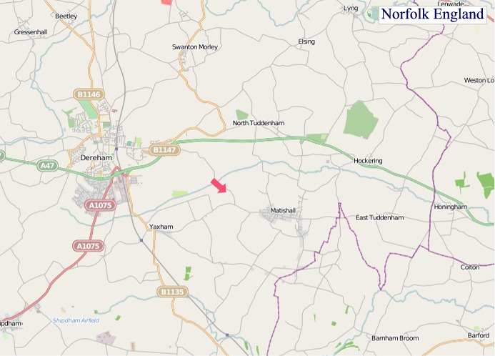
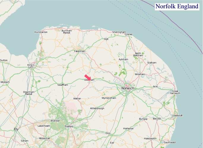
"© OpenStreetMap contributors, CC BY-SA".
Districts of Norfolk
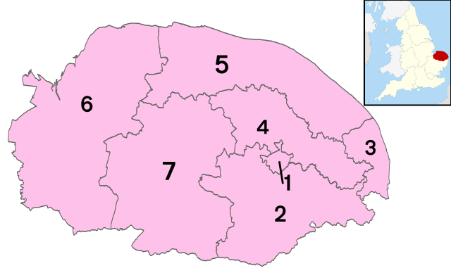
1 - Norwich
2 - South Norfolk
3 - Great Yarmouth
4 - Broadland
5 - North Norfolk
6 - King's Lynn and West Norfolk
7 - Breckland
From Wikipedia, the free encyclopedia
Norfolk City and Town Maps
A
B
C
D
E
F
G
H
I
K
L
M
N
O
P
R
S
T
U
W
Norfolk Maps — Interactive Map, Street View, Weather & News
This page provides an interactive Google map of Norfolk, England with Street View, satellite and terrain views, alongside links to detailed street maps for cities, towns, villages and hamlets across the county. Norfolk sits within the East of England region.
Every locality map page includes an embedded street and satellite map together with live weather where available — current conditions with hourly and 7-day outlooks powered by Open-Meteo. Local and world news feeds — including BBC News — keep pages current, and Wikipedia summaries provide additional local context.
The Search Maps button below the map opens OS Outdoor and the OS Explorer 1:25 000 sheets as base layers, with a labelled OS National Grid overlay, a distance and bearing tool, and a single-fix GPS readout giving your grid reference and latitude and longitude.
Location data is sourced from OS Open Names © Crown copyright and database rights 2024, Ordnance Survey, Open Government Licence v3.0, and verified by coordinates rather than name matching alone.