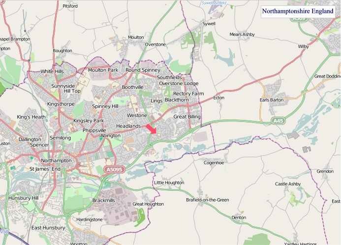
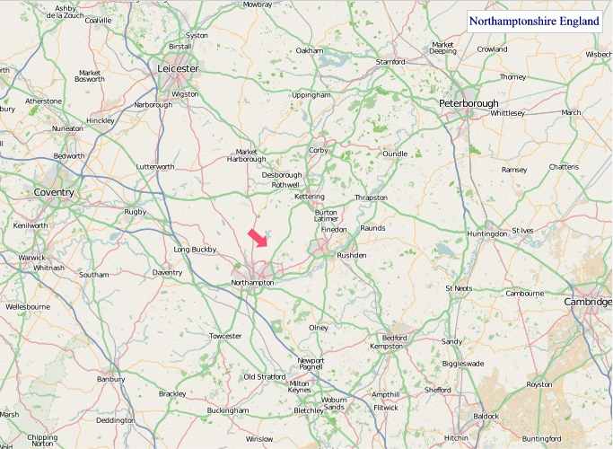
A large detailed map of Northamptonshire, England
Explore Northamptonshire with an interactive map featuring Street View, satellite and terrain views. Live weather, local news and location details for Northamptonshire — plus links to detailed street maps for cities, towns, villages and hamlets across the county.
Northamptonshire County Map
Map search is available for a limited number of queries per session to manage costs. Be specific — search precisely for best results.
| County Town | Northampton |
| Region | East Midlands |
| Country | England |
| Status | Ceremonial county |
| Area | 2,364 km² |
| Population | 773,000 |
| Latitude | 52.2863 |
| Longitude | -0.8832 |
| Cities & Towns | 396 |
| Locality Maps | Locality Maps |
About Northamptonshire
Gently undulating, Northamptonshire's terrain unfolds like a richly woven tapestry, its character defined by broad, fertile valleys and subtle rises rather than dramatic peaks. The River Nene, a serpentine artery, gracefully carves its path through the county, its banks often fringed with willow and alder, while the River Cherwell whispers its way along the western edge, a quieter counterpoint. Though landlocked, lacking the dramatic pronouncements of a coastline, the county possesses a natural, understated beauty, a pastoral elegance that speaks of ancient fields and enduring hedgerows, a landscape that invites contemplation rather than awe.
Echoes of antiquity resonate through Northamptonshire's long and varied past, beginning with Roman settlements such as Lactodorum near modern-day Towcester, a testament to the enduring power of strategic placement. Norman influence is palpable in the stonework of churches and the remnants of castles, a sturdy inheritance from a time of conquest and consolidation. The county played its part in the Wars of the Roses, and later, its strong Puritan leanings shaped the lives of many who sought new horizons across the Atlantic. Through centuries of agricultural evolution and burgeoning industrialisation, Northamptonshire has absorbed the imprints of each era, a living chronicle of England's unfolding narrative.
Agriculture has long been the bedrock of Northamptonshire's economy, its generous soils yielding bountiful harvests of cereals and supporting a thriving dairy and livestock sector, a tradition that persists with a modern, scientific vigour. Beyond the fields, the county's industrial heritage is indelibly linked to boot and shoe manufacturing, with towns like Northampton and Wellingborough once global centres for this craft, their factories now often repurposed into vibrant business hubs. Engineering and logistics also form significant pillars, attracting enterprises that benefit from the county's central location and excellent transport links, continuing a legacy of skilled production and commercial enterprise.
The people of Northamptonshire, often perceived as down-to-earth and possessing a quiet resilience, are shaped by the county's enduring rural rhythms and industrial grit. Traditions of hospitality are deeply ingrained, and a strong sense of community can be found in its market towns and villages, where local events and festivals maintain a connection to the past. While perhaps not a hotbed of avant-garde artistic movements, the county has nurtured a steady stream of talent in literature and the arts, its landscapes inspiring poets and painters alike. The way of life here is one of practical endeavour, grounded in the land and a steady appreciation for the enduring qualities of English countryside living.
Northamptonshire Maps
"© OpenStreetMap contributors, CC BY-SA".
Districts of Northamptonshire
(Unitary authority area)
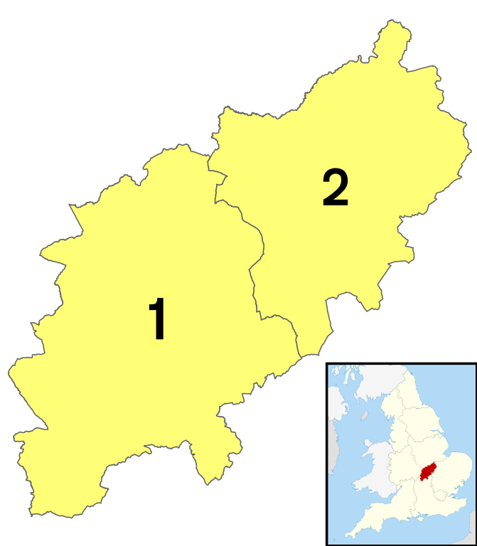
1 - West Northamptonshire
2 - North Northamptonshire
From Wikipedia, the free encyclopedia
Northamptonshire City and Town Maps
A
B
C
D
E
F
G
H
I
K
L
M
N
O
P
Q
R
S
T
U
W
Northamptonshire Maps — Interactive Map, Street View, Weather & News
This page provides an interactive Google map of Northamptonshire, England with Street View, satellite and terrain views, alongside links to detailed street maps for cities, towns, villages and hamlets across the county. Northamptonshire sits within the East Midlands region.
Every locality map page includes an embedded street and satellite map together with live weather where available — current conditions with hourly and 7-day outlooks powered by Open-Meteo. Local and world news feeds — including BBC News — keep pages current, and Wikipedia summaries provide additional local context.
Location data is sourced from OS Open Names © Crown copyright and database rights 2024, Ordnance Survey, Open Government Licence v3.0, and verified by coordinates rather than name matching alone.