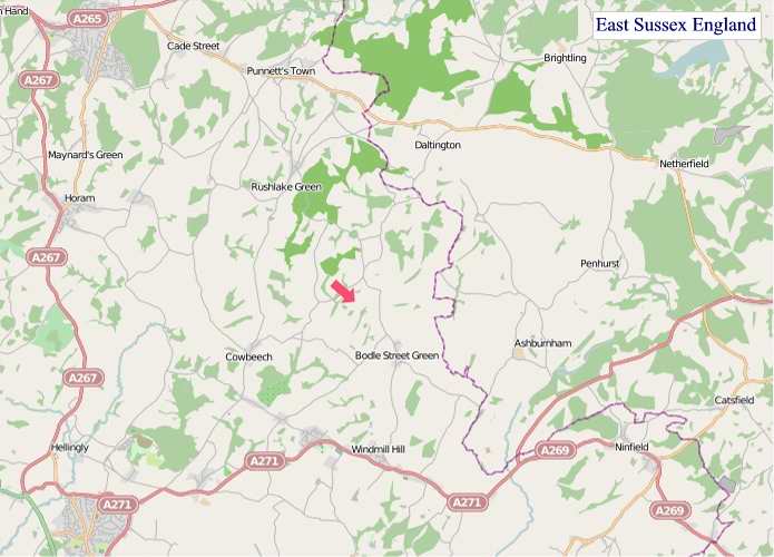
A large detailed map of East Sussex, England
Explore East Sussex with an interactive map featuring Street View, satellite and terrain views. Live weather, local news and location details for East Sussex — plus links to detailed street maps for cities, towns, villages and hamlets across the county.
East Sussex County Map
Map search is available for a limited number of queries per session to manage costs. Be specific — search precisely for best results.
| County Town | Lewes |
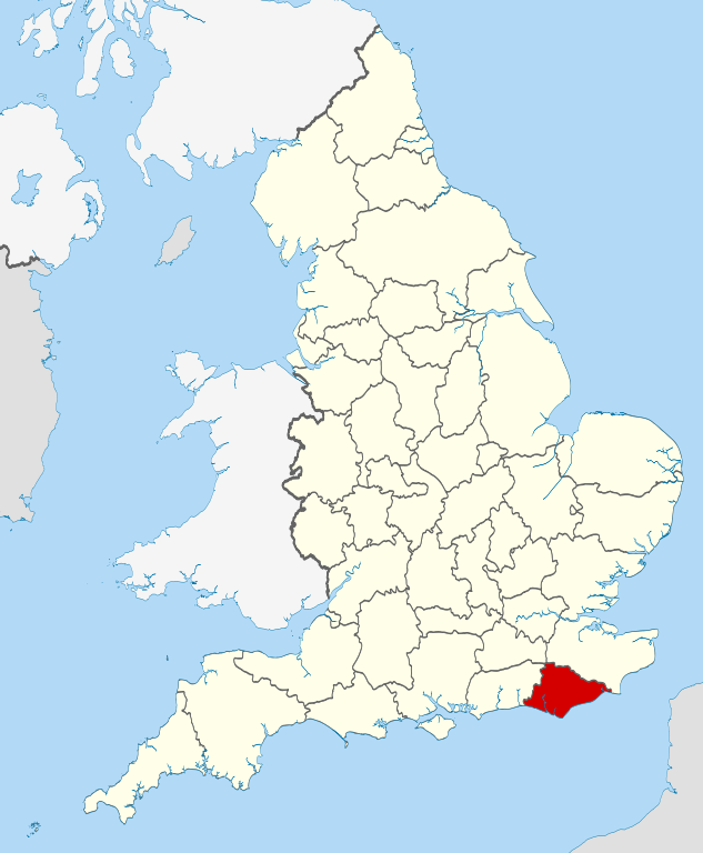
| Region | South East England |
| Country | England |
| Status | Ceremonial county |
| Area | 1,792 km² |
| Population | 856,000 |
| Latitude | 50.9292 |
| Longitude | 0.2465 |
| Cities & Towns | 480 |
| Locality Maps | Locality Maps |
About East Sussex
Verdant swells of the South Downs, ancient and weathered as a forgotten king's beard, roll towards the turbulent embrace of the English Channel. Here, chalky escarpments cleave the sky, their smooth contours sculpted by millennia of wind and rain, while the Ouse and Cuckmere rivers, silver serpents, carve their languid paths through verdant valleys. Along the coast, dramatic white cliffs plunge to shingle beaches, a rugged frontier where land surrenders to the ceaseless ebb and flow of the sea, and the air itself tastes of salt and wild thyme.
Echoes of Roman legions still whisper on the winds that sweep across Anderitum, though their stone forts have long since crumbled into the earth, yielding to Saxon settlements and later, Norman strongholds like Lewes Castle, a sentinel of conquest. Medieval market towns, with their higgledy-piggledy timber-framed houses, grew in the shadow of monastic ruins, surviving the Black Death and the Reformation's seismic shifts. The Georgian elegance of Brighton Pier and the Victorian grandeur of seaside resorts hint at later eras of leisure and industrial expansion, each stratum of history laid bare by the relentless march of time.
Agrarian pursuits, a timeless dance with the soil, continue to define much of the county's economic heart, with sheep grazing the Downs and hop fields climbing towards the summer sun. Beyond the fields, however, a more modern pulse beats; the heritage of brewing and the craft of fine engineering persist, alongside a burgeoning digital sector in Brighton and Hove, a testament to adaptability. Small-scale manufacturing, from artisan cheeses to bespoke furniture, thrives, often driven by a fierce independent spirit and a dedication to quality that honours tradition.
The spirit of East Sussex resides in its independent souls, a people shaped by the sea and the rolling hills, possessing a pragmatic charm and a dry wit. From the bohemian vibrancy of Brighton, a haven for artists and free thinkers, to the quiet resilience of rural hamlets, a tapestry of diverse lives unfolds. Traditional festivals, such as the Lewes Bonfire Night, erupt with fiery spectacle and a fierce sense of local identity, while the county's literary and artistic legacy, touched by figures like Virginia Woolf and Eric Gill, continues to inspire and captivate.
East Sussex Maps
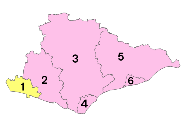
Districts of East Sussex
1 - City of Brighton and Hove
2 - Lewes
3 - Wealden
4 - Eastbourne
5 - Rother
6 - Hastings
"© OpenStreetMap contributors, CC BY-SA".
From Wikipedia, the free encyclopedia
East Sussex City and Town Maps
A
B
C
D
E
F
G
H
L
M
N
O
P
R
S
T
U
W
East Sussex Maps — Interactive Map, Street View, Weather & News
This page provides an interactive Google map of East Sussex, England with Street View, satellite and terrain views, alongside links to detailed street maps for cities, towns, villages and hamlets across the county. East Sussex sits within the South East England region.
Every locality map page includes an embedded street and satellite map together with live weather where available — current conditions with hourly and 7-day outlooks powered by Open-Meteo. Local and world news feeds — including BBC News — keep pages current, and Wikipedia summaries provide additional local context.
Location data is sourced from OS Open Names © Crown copyright and database rights 2024, Ordnance Survey, Open Government Licence v3.0, and verified by coordinates rather than name matching alone.