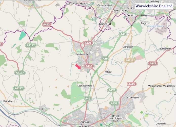
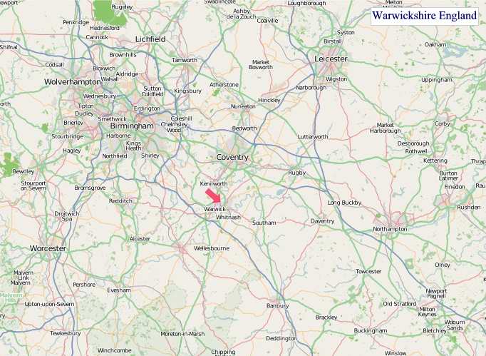
A large detailed map of Warwickshire, England
Explore Warwickshire with an interactive map featuring Street View, satellite and terrain views. Live weather, local news and location details for Warwickshire — plus links to detailed street maps for cities, towns, villages and hamlets across the county.
Warwickshire County Map
Map search is available for a limited number of queries per session to manage costs. Be specific — search precisely for best results.
| County Town | Warwick |
| Region | West Midlands |
| Country | England |
| Status | Ceremonial county |
| Area | 1,975 km² |
| Population | 600,000 |
| Latitude | 52.3153 |
| Longitude | -1.5893 |
| Cities & Towns | 474 |
| Locality Maps | Locality Maps |
About Warwickshire
Undulating softly, the Warwickshire landscape unfolds like an ancient tapestry woven with threads of verdant pasture and shadowed woodland. The Avon, a gentle serpent, threads its sinuous course through the heart of the county, its banks often fringed with willow and reed, reflecting the ever-changing moods of the English sky. Though devoid of dramatic peaks or a rugged coastline, its rolling hills, such as those around Shipston-on-Stour, possess a quiet, enduring beauty, a gentle embrace of nature that whispers tales of seasons past and present.
Echoes of Roman legions and Norman conquerors still resonate in the very soil of Warwickshire, a county whose history stretches back to the dawn of civilisation. Roman roads once crisscrossed its fertile plains, leading to settlements like Alcester, whilst later, the formidable Warwick Castle rose as a sentinel of power and strategy. The Wars of the Roses, a bloody chapter in England’s past, saw its strategic importance amplified, and the county continued to witness the ebb and flow of national events through the Tudor and Stuart eras, right up to its industrial awakenings.
The lifeblood of Warwickshire has long been its fertile earth, yielding bountiful harvests that have sustained its people for centuries, with agriculture remaining a cornerstone of its economy. Yet, this agrarian tradition has been powerfully augmented by a robust industrial heritage, particularly in the realm of manufacturing and engineering, epitomised by the automotive and aerospace sectors that have flourished around Coventry. Smaller, specialised enterprises, from artisan food producers to innovative technology firms, continue to thrive, demonstrating a dynamic blend of the traditional and the cutting-edge.
Here, a quiet dignity often characterises the people of Warwickshire, their demeanour reflecting the enduring spirit of the countryside and the industriousness of its towns. Traditions are cherished, from the lively street markets of Stratford-upon-Avon to the agricultural shows that punctuate the summer calendar, whilst the county's most illustrious son, William Shakespeare, continues to draw pilgrims from across the globe, his words weaving an indelible cultural thread. The way of life is one that balances the demands of modern enterprise with a deep appreciation for heritage and the natural world.
Warwickshire Maps
"© OpenStreetMap contributors, CC BY-SA".
Districts of Warwickshire

1 - North Warwickshire
2 - Nuneaton and Bedworth
3 - Rugby
4 - Stratford-on-Avon
5 - Warwick
From Wikipedia, the free encyclopedia
Warwickshire City and Town Maps
A
B
C
D
E
F
G
H
I
K
L
M
N
O
P
R
S
T
U
W
Warwickshire Maps — Interactive Map, Street View, Weather & News
This page provides an interactive Google map of Warwickshire, England with Street View, satellite and terrain views, alongside links to detailed street maps for cities, towns, villages and hamlets across the county. Warwickshire sits within the West Midlands region.
Every locality map page includes an embedded street and satellite map together with live weather where available — current conditions with hourly and 7-day outlooks powered by Open-Meteo. Local and world news feeds — including BBC News — keep pages current, and Wikipedia summaries provide additional local context.
Location data is sourced from OS Open Names © Crown copyright and database rights 2024, Ordnance Survey, Open Government Licence v3.0, and verified by coordinates rather than name matching alone.