A large detailed map of Lancashire, England
Explore Lancashire with an interactive map featuring Street View, satellite and terrain views. Live weather, local news and location details for Lancashire — plus links to detailed street maps for cities, towns, villages and hamlets across the county.
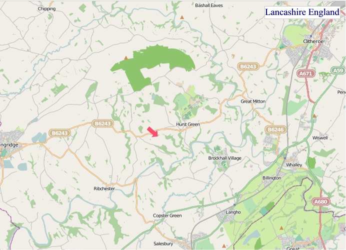
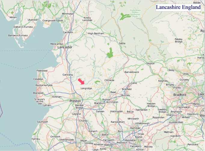
Lancashire County Map
Map search is available for a limited number of queries per session to manage costs. Be specific — search precisely for best results.
| County Town | Preston |
| Region | North West England |
| Country | England |
| Status | Ceremonial county |
| Area | 3,075 km² |
| Population | 1,502,000 |
| Latitude | 53.7985 |
| Longitude | -2.6009 |
| Cities & Towns | 880 |
| Locality Maps | Locality Maps |
About Lancashire
Molded by ancient glaciers, Lancashire's terrain unfolds in a tapestry of rolling hills and fertile plains, the Pennine spine affording dramatic vistas towards the east, while the west dissolves into the shimmering expanse of the Irish Sea. Rivers, like the Ribble and the Lune, carve serpentine paths through the land, their waters nourishing the rich agricultural soil and whispering tales of centuries past as they journey towards the coast. The Fylde coast offers a more gentle embrace, its sandy shores a stark contrast to the rugged beauty of Pendle Hill, a brooding sentinel that has witnessed the ebb and flow of human endeavour.
Echoes of Roman legions linger in the earth, their roads a subtle testament to early dominion, but it was the Norman Conquest that truly imprinted its mark, laying the foundations for towns like Lancaster, a venerable seat of power. Centuries later, the Industrial Revolution roared through the county, transforming its quiet villages into bustling centres of cotton manufacture, a period of unprecedented change that shaped the modern Lancashire character. From the medieval glories of Whalley Abbey to the stark realities of Victorian mill towns, history here is not merely recorded but palpably felt.
Agriculture, once the bedrock of Lancashire's prosperity, continues to sustain the county, with dairy farms and market gardens dotting the landscape, producing fine cheeses and fresh produce. Yet, the soul of Lancashire's economy has long been inextricably bound to its industrial prowess, particularly the cotton mills that once dominated the global textile market, giving rise to towns like Blackburn and Preston. While the era of vast textile empires has waned, the spirit of innovation endures, with modern enterprises in aerospace, advanced manufacturing, and digital technologies now driving progress.
The people of Lancashire possess a characteristic resilience and a forthright spirit, their humour often as dry as the Yorkshire moors but tempered with a warmth that belies their stoic exterior. Traditions, from the annual Wakes Weeks that once brought industry to a standstill to the enduring love of brass bands, are woven into the fabric of daily life, a testament to a deep-seated sense of community. Figures like the poet Philip Larkin, though not born there, found inspiration in its industrial heartlands, while the county continues to nurture artists and thinkers who reflect its enduring soul.
Lancashire Maps
"© OpenStreetMap contributors, CC BY-SA".
Districts of Lancashire
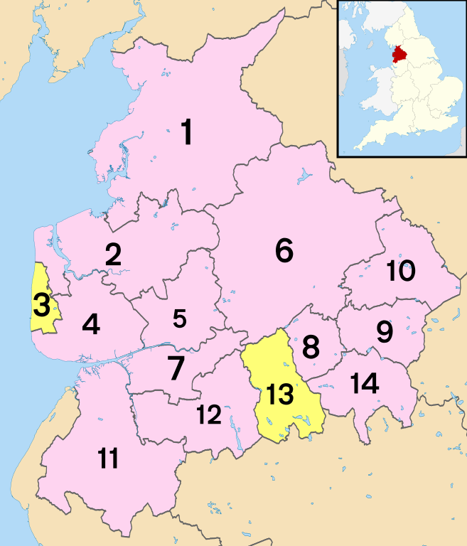
1 - City of Lancaster
2 - Wyre
3 - Blackpool
4 - Fylde
5 - City of Preston
6 - Ribble Valley
7 - South Ribble
8 - Hyndburn
9 - Burnley
10 - Pendle
11 - West Lancashire
12 - Chorley
13 - Blackburn with Darwen
14 - Rossendale
From Wikipedia, the free encyclopedia
Lancashire City and Town Maps
A
B
C
D
E
F
G
H
I
K
L
M
N
O
P
Q
R
S
T
W
Lancashire Maps — Interactive Map, Street View, Weather & News
This page provides an interactive Google map of Lancashire, England with Street View, satellite and terrain views, alongside links to detailed street maps for cities, towns, villages and hamlets across the county. Lancashire sits within the North West England region.
Every locality map page includes an embedded street and satellite map together with live weather where available — current conditions with hourly and 7-day outlooks powered by Open-Meteo. Local and world news feeds — including BBC News — keep pages current, and Wikipedia summaries provide additional local context.
Location data is sourced from OS Open Names © Crown copyright and database rights 2024, Ordnance Survey, Open Government Licence v3.0, and verified by coordinates rather than name matching alone.