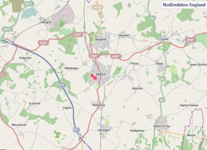
A large detailed map of Bedfordshire, England
Explore Bedfordshire with an interactive map featuring Street View, satellite and terrain views. Live weather, local news and location details for Bedfordshire — plus links to detailed street maps for cities, towns, villages and hamlets across the county.
Bedfordshire County Map
Map search is available for a limited number of queries per session to manage costs. Be specific — search precisely for best results.
| County Town | Bedford |
| Region | East of England |
| Country | England |
| Status | Ceremonial county |
| Area | 1,235 km² |
| Population | 699,000 |
| Latitude | 52.0575 |
| Longitude | -0.4571 |
| Cities & Towns | 337 |
| Locality Maps | Locality Maps |
About Bedfordshire
Gently rolling hills, a hallmark of the English Midlands, define Bedfordshire's pastoral character, seldom rising to dramatic heights but offering a pleasant undulation across its fertile plains. The Great Ouse, a placid artery, meanders through the county, its waters reflecting the verdant meadows and occasional woodlands that dot the landscape, contributing to a generally serene and unassuming natural beauty, devoid of rugged coasts or imposing mountains but possessing a quiet charm that speaks of ancient husbandry.
Centuries whisper through its ancient earth, from the enduring marks of Roman roads that once crisscrossed its soil to the Saxon settlements that gave rise to enduring villages, Bedfordshire has witnessed the ebb and flow of English history. The Norman conquest left its indelible stamp on manors and churches, whilst the Civil War saw skirmishes and loyalties tested across its fields, leading into the industrial stirrings of the 18th and 19th centuries that began to reshape its quiet existence.
Agriculture has long been the lifeblood of Bedfordshire, its chalk soils yielding bountiful harvests of wheat, barley, and sugar beet, a tradition sustained by generations of dedicated farmers. Beyond the fields, Luton's heritage of hat-making, though largely past, foreshadowed a modern economy diversified by manufacturing, logistics, and a growing service sector, with Bedford itself a hub for varied commercial activities that sustain its populace.
The people of Bedfordshire, often characterised by a sturdy pragmatism and a quiet resilience, reflect the county's enduring agricultural roots and its evolving industrial present, a blend that shapes their traditions and outlook. While grand artistic movements may have largely passed it by, the county has nurtured its own quiet cultural expressions, from local festivals to a bedrock of community spirit that underpins the everyday lives of its inhabitants, fostering a sense of place and belonging.
Bedfordshire Maps
"© OpenStreetMap contributors, CC BY-SA".
Districts of Bedfordshire
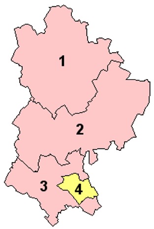
1 - Bedford
2 - Mid Bedfordshire
3 - South Bedfordshire
4 - Luton
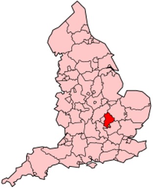
From Wikipedia, the free encyclopedia
Bedfordshire City and Town Maps
A
B
C
D
E
F
G
H
K
L
M
N
O
P
R
S
T
U
W
Y
Bedfordshire Maps — Interactive Map, Street View, Weather & News
This page provides an interactive Google map of Bedfordshire, England with Street View, satellite and terrain views, alongside links to detailed street maps for cities, towns, villages and hamlets across the county. Bedfordshire sits within the East of England region.
Every locality map page includes an embedded street and satellite map together with live weather where available — current conditions with hourly and 7-day outlooks powered by Open-Meteo. Local and world news feeds — including BBC News — keep pages current, and Wikipedia summaries provide additional local context.
Location data is sourced from OS Open Names © Crown copyright and database rights 2024, Ordnance Survey, Open Government Licence v3.0, and verified by coordinates rather than name matching alone.