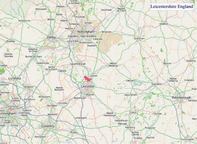
A large detailed map of Leicestershire, England
Explore Leicestershire with an interactive map featuring Street View, satellite and terrain views. Live weather, local news and location details for Leicestershire — plus links to detailed street maps for cities, towns, villages and hamlets across the county.
Leicestershire County Map
Map search is available for a limited number of queries per session to manage costs. Be specific — search precisely for best results.
| County Town | Leicester |
| Region | East Midlands |
| Country | England |
| Status | Ceremonial county |
| Area | 2,156 km² |
| Population | 1,104,000 |
| Latitude | 52.6594 |
| Longitude | -1.1407 |
| Cities & Towns | 422 |
| Locality Maps | Locality Maps |
About Leicestershire
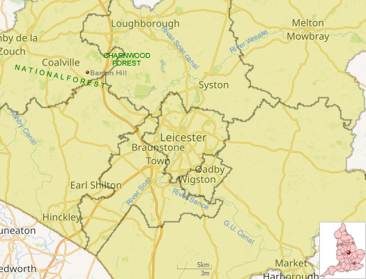
Gentle undulations define Leicestershire's terrain, a tapestry woven from rolling farmland and meandering watercourses. The River Soar, a placid artery, carves its way south to north, feeding the county's verdant plains, whilst the smaller Sence and Anker offer their own quiet contributions to the hydrological symphony. There are no dramatic coastal cliffs here, nor imposing mountain ranges; instead, a more subtle beauty prevails, a landscape of quiet dignity marked by ancient woodlands and the occasional, shy rise of hills like Beacon Hill, offering soft panoramas rather than stark pronouncements.
Echoes of antiquity resonate through this land, from the Roman foundations at Ratby to the Norman stronghold of Leicester Castle. Viking raids left their mark upon the Danelaw, and the Wars of the Roses saw the pivotal Battle of Bosworth Field, a clash that irrevocably altered the course of English monarchy. Later centuries witnessed the burgeoning of market towns like Loughborough and Melton Mowbray, centres of commerce and community that grew alongside the nation’s industrial might, each era etching its unique story into the very soil.
Prosperity has long been cultivated from Leicestershire's fertile earth, with agriculture remaining a cornerstone of its economy, particularly in the rearing of livestock and the growth of cereal crops. Beyond the fields, a strong industrial heritage persists, evident in the automotive sector and the manufacture of textiles, a legacy continued by enterprises such as Caterpillar in Desford. Engineering prowess also thrives, contributing significantly to the county's enduring economic vitality and employment.
A spirit of sturdy practicality and quiet resilience characterises the people of Leicestershire, a populace whose traditions are often rooted in the rhythms of rural life and the fellowship of local communities. The county has nurtured figures of note, from the poet Philip Sidney to the pioneering scientist Sir Jagdish Chandra Bose, and continues to foster a vibrant arts scene, with theatres and galleries in Leicester itself offering avenues for creative expression and cultural enrichment, reflecting a way of life both grounded and aspirational.
Leicestershire Maps
"© OpenStreetMap contributors, CC BY-SA".
Districts of Leicestershire
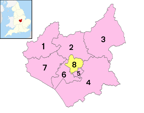
1 - North West Leicestershire
2 - Charnwood
3 - Melton
4 - Harborough
5 - Oadby and Wigston
6 - Blaby
7 - Hinckley and Bosworth
8 - City of Leicester
From Wikipedia, the free encyclopedia
Leicestershire City and Town Maps
A
B
C
D
E
F
G
H
K
L
M
N
O
P
Q
R
S
T
W
Leicestershire Maps — Interactive Map, Street View, Weather & News
This page provides an interactive Google map of Leicestershire, England with Street View, satellite and terrain views, alongside links to detailed street maps for cities, towns, villages and hamlets across the county. Leicestershire sits within the East Midlands region.
Every locality map page includes an embedded street and satellite map together with live weather where available — current conditions with hourly and 7-day outlooks powered by Open-Meteo. Local and world news feeds — including BBC News — keep pages current, and Wikipedia summaries provide additional local context.
Location data is sourced from OS Open Names © Crown copyright and database rights 2024, Ordnance Survey, Open Government Licence v3.0, and verified by coordinates rather than name matching alone.