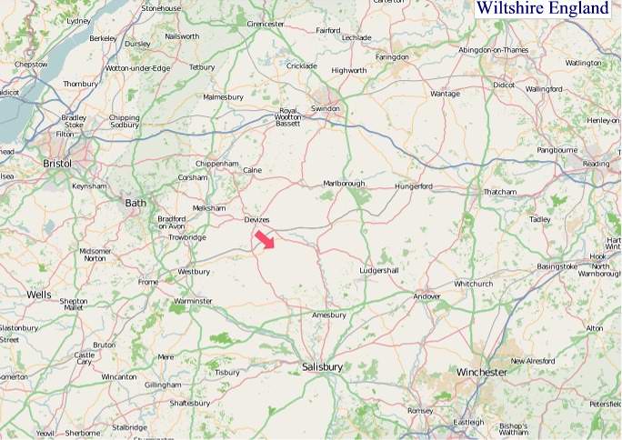
A large detailed map of Wiltshire, England
Explore Wiltshire with an interactive map featuring Street View, satellite and terrain views. Live weather, local news and location details for Wiltshire — plus links to detailed street maps for cities, towns, villages and hamlets across the county.
Wiltshire County Map
Map search is available for a limited number of queries per session to manage costs. Be specific — search precisely for best results.
| County Town | Trowbridge |
| Region | South West England |
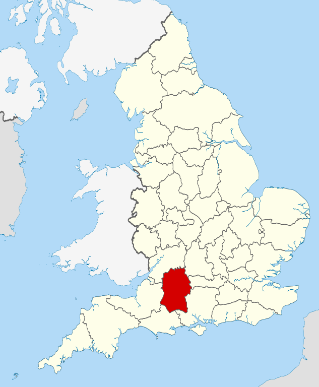
| Country | England |
| Status | Ceremonial county |
| Area | 3,485 km² |
| Population | 499,000 |
| Latitude | 51.3337 |
| Longitude | -1.9607 |
| Cities & Towns | 835 |
| Locality Maps | Locality Maps |
About Wiltshire
Undulating chalk downs, ancient and vast, form the very sinew of Wiltshire, a county where the land itself whispers tales of millennia. The Salisbury Plain, a seemingly boundless expanse of rolling grassland, flows into the gentle valleys carved by the Avon and Wylye rivers, their waters glinting like silver threads across the verdant tapestry. Though landlocked, a maritime spirit can be sensed in the expansive horizons and the ceaseless, wind-swept beauty that defines this pastoral heartland, a landscape that has sculpted its inhabitants for generations. The iconic White Horses, etched into the hillsides, stand as enduring testaments to this deep connection between people and the earth.
Echoes of the distant past resonate powerfully through Wiltshire, a land where history is not merely read but felt beneath one's feet. From the Neolithic grandeur of Stonehenge, a cyclopean enigma that has defied mortal understanding for over four thousand years, to the Roman villa at Woodchester, the county bears witness to successive waves of civilisation. The Norman conquest left its indelible mark in the form of imposing castles and cathedrals, while the wool trade, a veritable engine of medieval prosperity, funded the construction of magnificent parish churches that still grace its market towns. The Civil War saw fierce skirmishes across its plains, and the modern era continues to add its own layers to this profound historical palimpsest.
Predominantly agrarian in its character, Wiltshire's economy remains deeply rooted in the soil that has sustained it for centuries, with swathes of land dedicated to cereal crops and livestock. However, this pastoral idyll is increasingly complemented by a robust industrial sector, particularly in aerospace and defence, with major enterprises like Rolls-Royce and BAE Systems maintaining significant presences. The historic market towns, such as Marlborough and Salisbury, continue to thrive as centres of commerce and skilled craftsmanship, their independent shops and local producers contributing to a vibrant and diverse economic ecosystem. Furthermore, the burgeoning tourism industry, drawn by its historical treasures and natural beauty, provides a vital and growing source of income.
The people of Wiltshire, much like their landscape, possess a quiet resilience and a deep-seated connection to their heritage, embodying a sense of understated pride in their county. Generations have cultivated a way of life that values community, tradition, and a respect for the natural world, a spirit reflected in the county's vibrant agricultural shows and local festivals. Notable figures, from the poet laureate Sir John Betjeman, who captured its melancholic charm, to the pioneering scientist Joseph Priestley, have drawn inspiration from its tranquil environs. The arts flourish in its numerous galleries and theatres, contributing to a cultural tapestry that is both deeply traditional and refreshingly contemporary.
Wiltshire Maps
"© OpenStreetMap contributors, CC BY-SA".
Districts of Wiltshire
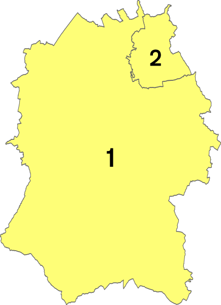
1 - Wiltshire
2 - Swindon
From Wikipedia, the free encyclopedia
Wiltshire City and Town Maps
A
B
C
D
E
F
G
H
K
L
M
N
O
P
R
S
T
U
V
W
Y
Wiltshire Maps — Interactive Map, Street View, Weather & News
This page provides an interactive Google map of Wiltshire, England with Street View, satellite and terrain views, alongside links to detailed street maps for cities, towns, villages and hamlets across the county. Wiltshire sits within the South West England region.
Every locality map page includes an embedded street and satellite map together with live weather where available — current conditions with hourly and 7-day outlooks powered by Open-Meteo. Local and world news feeds — including BBC News — keep pages current, and Wikipedia summaries provide additional local context.
Location data is sourced from OS Open Names © Crown copyright and database rights 2024, Ordnance Survey, Open Government Licence v3.0, and verified by coordinates rather than name matching alone.