A large detailed map of Nottinghamshire, England
Explore Nottinghamshire with an interactive map featuring Street View, satellite and terrain views. Live weather, local news and location details for Nottinghamshire — plus links to detailed street maps for cities, towns, villages and hamlets across the county.
Nottinghamshire County Map
Map search is available for a limited number of queries per session to manage costs. Be specific — search precisely for best results.
| County Town | Nottingham |
| Region | East Midlands |
| Country | England |
| Status | Ceremonial county |
| Area | 2,160 km² |
| Population | 1,139,000 |
| Latitude | 53.1094 |
| Longitude | -1.0484 |
| Cities & Towns | 460 |
| Locality Maps | Locality Maps |
About Nottinghamshire
Rolling ridges of the Dukeries give way to the gentle, serpentine coils of the River Trent, which carves a silver vein through the verdant heart of the shire. Sherwood Forest remains a tangled memory of oak and bracken, where the light dapples upon ancient boughs in patterns of shifting, bronze-hued gloom. Limestone outcrops rise like jagged teeth near Creswell Crags, guarding secrets of primeval hearths long cold beneath the soil. Undulating fields of the Trent Valley offer a pastoral quietude, punctuated by the sudden, sharp incline of the Wolds that command the horizon. Nature here possesses a melancholic grace, a landscape dreaming of lost kingdoms and the slow, inexorable pulse of the seasons.
Danelaw echoes still vibrate through the street-names of Newark and Southwell, remnants of a time when Norse prows cut deep into the midland clay. Roman legions once marched the Fosse Way, their iron-shod boots leaving phantom imprints upon the stubborn earth that would later witness the dramatic siege of Nottingham Castle. Civil War skirmishes fractured the peace of this shire, turning manor houses into fortresses and brothers into bitter, warring ghosts. Industrial expansion later grafted a new, soot-stained history onto the medieval frame, as pit-heads rose like dark sentinels over the coal-seams of the Erewash valley. Layers of time accumulate here like sediment, each epoch pressing upon the last to form the bedrock of a complex, layered identity.
Factories once hummed with the rhythmic clatter of lace-looms, weaving intricate webs that clothed the aristocracy and the commoner alike in gossamer threads of exquisite craftsmanship. Nottingham’s Victorian reputation as the lace capital of the world birthed fortunes that transformed the cityscape into a gallery of red-brick ambition and grand, civic pride. Agriculture persists as a sturdy pillar, with vast, golden acres of wheat and barley feeding the hunger of a nation that has long relied upon this fertile basin. Boots, the apothecary’s vision, grew from a modest herbalist shop in the city to a global titan of wellness and pharmaceutical enterprise. Prosperity ebbs and flows through the veins of this county, mirroring the shifting tides of British manufacture and the relentless ingenuity of its working folk.
D.H. Lawrence, that brooding son of Eastwood, captured the raw, pulsing tension of these mining villages with a prose that burns like a guttering candle in the dark. Traditions endure in the stubborn spirit of the people, a character forged in the furnace of the hearth and tempered by the communal solidarity of the local pub. Robin Hood remains the mercurial patron of these woods, a mythic figure whose bow-string twangs in the collective imagination of every child born beneath the shadow of the Major Oak. Poets and playwrights have long drawn sustenance from the earthy, uncompromising vernacular that colours daily discourse in the market squares of Mansfield and Retford. Life here is a quiet, persistent symphony, played out by individuals who carry the weight of their heritage with a stoic, unpretentious honour.
Nottinghamshire Maps
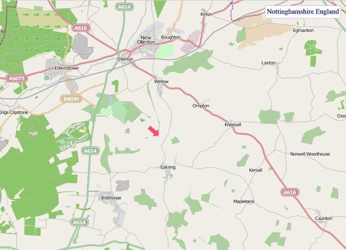
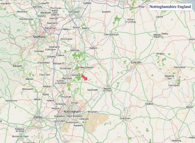
"© OpenStreetMap contributors, CC BY-SA".
Districts of Nottinghamshire
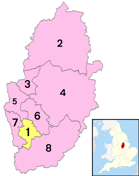
1 - City of Nottingham
2 - Bassetlaw
3 - Mansfield
4 - Newark and Sherwood
5 - Ashfield
6 - Gedling
7 - Broxtowe
8 - Rushcliffe
From Wikipedia, the free encyclopedia
Nottinghamshire City and Town Maps
A
B
C
D
E
F
G
H
I
K
L
M
N
O
P
R
S
T
U
W
Z
Nottinghamshire Maps — Interactive Map, Street View, Weather & News
This page provides an interactive Google map of Nottinghamshire, England with Street View, satellite and terrain views, alongside links to detailed street maps for cities, towns, villages and hamlets across the county. Nottinghamshire sits within the East Midlands region.
Every locality map page includes an embedded street and satellite map together with live weather where available — current conditions with hourly and 7-day outlooks powered by Open-Meteo. Local and world news feeds — including BBC News — keep pages current, and Wikipedia summaries provide additional local context.
The Search Maps button below the map opens OS Outdoor and the OS Explorer 1:25 000 sheets as base layers, with a labelled OS National Grid overlay, a distance and bearing tool, and a single-fix GPS readout giving your grid reference and latitude and longitude.
Location data is sourced from OS Open Names © Crown copyright and database rights 2024, Ordnance Survey, Open Government Licence v3.0, and verified by coordinates rather than name matching alone.