Enter your search query in the box below.
English Channel Maps
Explore the English Channel with this interactive street and satellite map. You can “grab” the map and move it around to re-centre it, and use the zoom buttons to zoom in or out to street-level detail. You will find live weather, local and world news below.
Interactive Map of the English Channel
About the English Channel
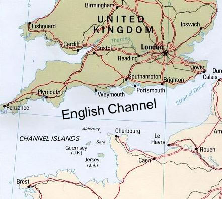
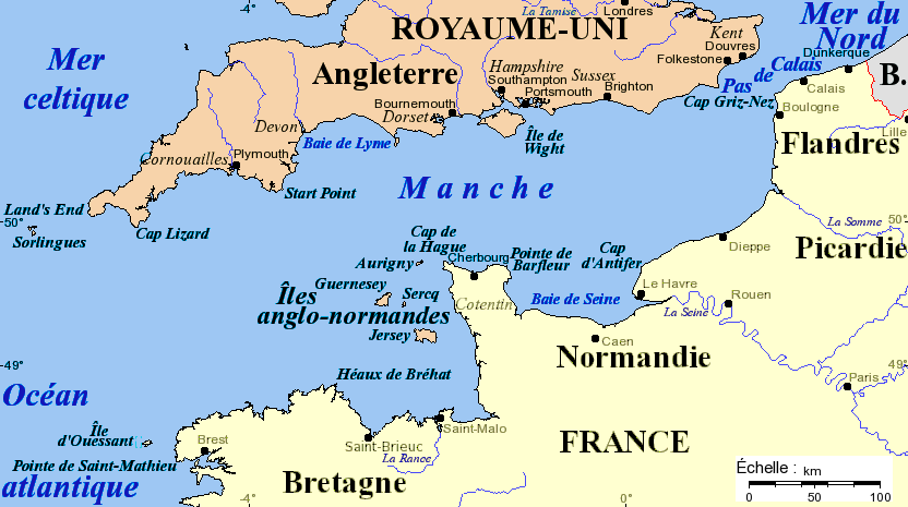
The English Channel (French: La Manche, "the sleeve") is an arm of the Atlantic Ocean that separates England from northern France, and joins the North Sea to the Atlantic. It is about 560 km (350 mi) long and varies in width from 240 km (150 mi) at its widest, to only 34 km (21 mi) in the Strait of Dover. It is the smallest of the shallow seas around the continental shelf of Europe, covering an area of some 75,000 km² (29,000 sq mi).
Latest News: English Channel
Loading news…
World News
Loading news…
BBC World News
Loading news…
An English Channel Map