A large detailed map of Suffolk, England
Explore Suffolk with an interactive map featuring Street View, satellite and terrain views. Live weather, local news and location details for Suffolk — plus links to detailed street maps for cities, towns, villages and hamlets across the county.
Suffolk County Map
Map search is available for a limited number of queries per session to manage costs. Be specific — search precisely for best results.
| County Town | Ipswich |
| Region | East of England |
| Country | England |
| Status | Ceremonial county |
| Area | 3,801 km² |
| Population | 759,000 |
| Latitude | 52.2049 |
| Longitude | 1.0697 |
| Cities & Towns | 922 |
| Locality Maps | Locality Maps |
About Suffolk
Lowland vistas of Suffolk unfold in a tapestry of gentle undulations, where the Stour and the Orwell carve silver ribbons through the verdant clay. Salt-marsh horizons meet the North Sea at Dunwich, where the relentless tides reclaim the land in a melancholic dance of erosion. Ancient heaths of heather and gorse provide sanctuary for the stone-curlew, their silent beauty defying the clamour of modernity. Windswept cliffs of crumbling crag guard the shoreline, offering a rugged contrast to the serene, willow-fringed meadows of the Dedham Vale. Nature here breathes in a rhythm of quietude, untouched by the jagged peaks of harsher climes.
Ipswich stands as a sentinel of antiquity, its foundations laid by Roman ambition and later fortified by the watchful gaze of Saxon kings. Viking longships once tested these estuaries, leaving behind a legacy of conflict that eventually softened into the prosperity of the medieval wool trade. Centuries of ecclesiastical devotion transformed the landscape, evidenced by the soaring flint towers of parish churches that pierce the Suffolk sky like prayers made stone. Royal lineages and revolutionary spirits have traversed these lanes, leaving echoes of the Civil War and the quiet resolve of the English Reformation. Time itself seems to pause amongst the timber-framed halls of Lavenham, where the past remains a living presence.
Agriculture commands the heartbeat of this pastoral realm, where golden harvests of barley and wheat ripple beneath a vast, cloud-dappled firmament. Farmers have long coaxed abundance from the heavy loam, ensuring that the county remains the granary of the realm despite the shifting tides of global commerce. Modern innovation now thrives alongside tradition, as engineering enterprises and maritime logistics flourish within the bustling confines of Felixstowe port. Craftsmanship survives in the artisanal food production and the enduring legacy of local brewing, which honours the heritage of the soil. Sustenance and industry walk hand in hand, tethering the modern economy to the enduring fertility of the East Anglian plain.
Artists have long sought the ethereal light of this coast, capturing the soul of the landscape through the masterful brushstrokes of Constable and Gainsborough. People of the region possess a stoic humour, a quiet resilience forged by generations of working the earth and braving the bracing North Sea gales. Traditions linger in the village fetes and the spirited folk music that reverberates through ancient public houses long after the sun has dipped below the horizon. Benjamin Britten found his muse within the brine and shingle of Aldeburgh, weaving the very essence of the sea into his haunting compositions. Such creative spirits define the Suffolk character, proving that profound art can bloom within the most modest of corners.
Suffolk Maps
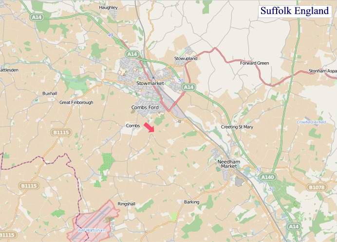
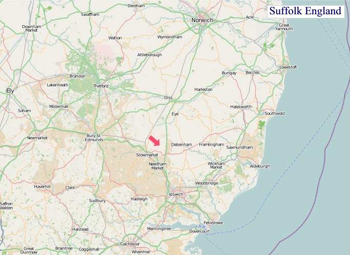
"© OpenStreetMap contributors, CC BY-SA".
Districts of Suffolk
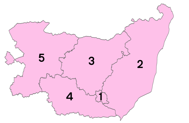
1 - West Suffolk
2 - Mid Suffolk
3 - Babergh
4 - Ipswich
5 - East Suffolk
From Wikipedia, the free encyclopedia
Suffolk City and Town Maps
A
B
C
D
E
F
G
H
I
K
L
M
N
O
P
R
S
T
U
W
Suffolk Maps — Interactive Map, Street View, Weather & News
This page provides an interactive Google map of Suffolk, England with Street View, satellite and terrain views, alongside links to detailed street maps for cities, towns, villages and hamlets across the county. Suffolk sits within the East of England region.
Every locality map page includes an embedded street and satellite map together with live weather where available — current conditions with hourly and 7-day outlooks powered by Open-Meteo. Local and world news feeds — including BBC News — keep pages current, and Wikipedia summaries provide additional local context.
The Search Maps button below the map opens OS Outdoor and the OS Explorer 1:25 000 sheets as base layers, with a labelled OS National Grid overlay, a distance and bearing tool, and a single-fix GPS readout giving your grid reference and latitude and longitude.
Location data is sourced from OS Open Names © Crown copyright and database rights 2024, Ordnance Survey, Open Government Licence v3.0, and verified by coordinates rather than name matching alone.