A large detailed map of Isle of Wight, England
Explore Isle of Wight with an interactive map featuring Street View, satellite and terrain views. Live weather, local news and location details for Isle of Wight — plus links to detailed street maps for cities, towns, villages and hamlets across the county.
Isle of Wight County Map
Map search is available for a limited number of queries per session to manage costs. Be specific — search precisely for best results.
| County Town | Newport |
| Region | South East England |
| Country | England |
| Status | Unitary authority |
| Area | 380 km² |
| Population | 141,000 |
| Latitude | 50.6753 |
| Longitude | -1.2946 |
| Cities & Towns | 168 |
| Locality Maps | Locality Maps |
About Isle of Wight
Chalky ramparts rise defiantly above the churning Solent, where the Needles stand as jagged sentinels against the relentless grey swell of the English Channel. Rolling downs, draped in the velvet green of ancient turf, undulate towards the Medina’s winding course, which bisects the island like a silver ribbon through the clay. Rugged cliffs at Compton Bay reveal the fossilised secrets of a prehistoric epoch, whilst hidden chines carve deep, verdant gashes into the southern coastline. Wind-sculpted hawthorn trees bow before the salt-laden gales that sweep across the Tennyson Down, lending the landscape a posture of perpetual, melancholic obeisance. Nature here remains a wild, sequestered kingdom, untamed by the frantic pace of the mainland.
Victorian monarchs once transformed this insular outpost into the imperial heart of their summer retreat, forever altering the architectural silhouette of East Cowes. Osborne House stands as a testament to Albert’s architectural vision, its Italianate towers gleaming white against the verdant canopy of the royal estate. Roman legions formerly trod the mosaic floors of the villa at Brading, leaving behind the intricate, colourful echoes of a Mediterranean past. Carisbrooke Castle looms over the central plains, its grey stone walls still whispering of King Charles the First’s desperate, failed captivity behind those cold, iron-barred windows. Centuries of maritime defence and royal favour have woven a tapestry of history that clings to every crumbling battlement.
Agricultural abundance defines the island’s verdant interior, where fields of garlic and golden wheat flourish beneath a sun that seems to linger longer than elsewhere. Aerospace engineering once propelled the region toward a futuristic horizon, with the hovercraft’s invention at East Cowes marking a radical departure from traditional maritime transport. Boatbuilding traditions continue to thrive in the sheltered harbours of Bembridge and Cowes, where master craftsmen honour the legacy of the legendary J. Samuel White shipyard. Tourism remains the primary engine of modern prosperity, drawing multitudes to the seaside promenades that hum with the quiet industry of hospitality. Prosperity here is a delicate balance between the rustic toil of the furrow and the high-tech precision of the modern assembly line.
Bohemian spirits and literary giants have long sought the island’s tranquil seclusion to nurture their creative flames. Alfred Lord Tennyson paced the windswept ridges of Freshwater, his verses capturing the very essence of the mist-shrouded downs and the mournful music of the tide. Traditional festivals and the annual yachting regatta inject a vibrant, rhythmic pulse into the local way of life, bridging the gap between ancestral custom and contemporary social flair. Islanders possess a stoic, independent character, forged by the surrounding tides that separate them from the hurried sprawl of the southern counties. Art, poetry, and a profound respect for the sea constitute the enduring marrow of this tight-knit, coastal community.
Isle of Wight Maps
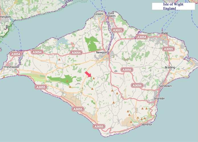
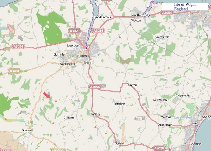
"© OpenStreetMap contributors, CC BY-SA".
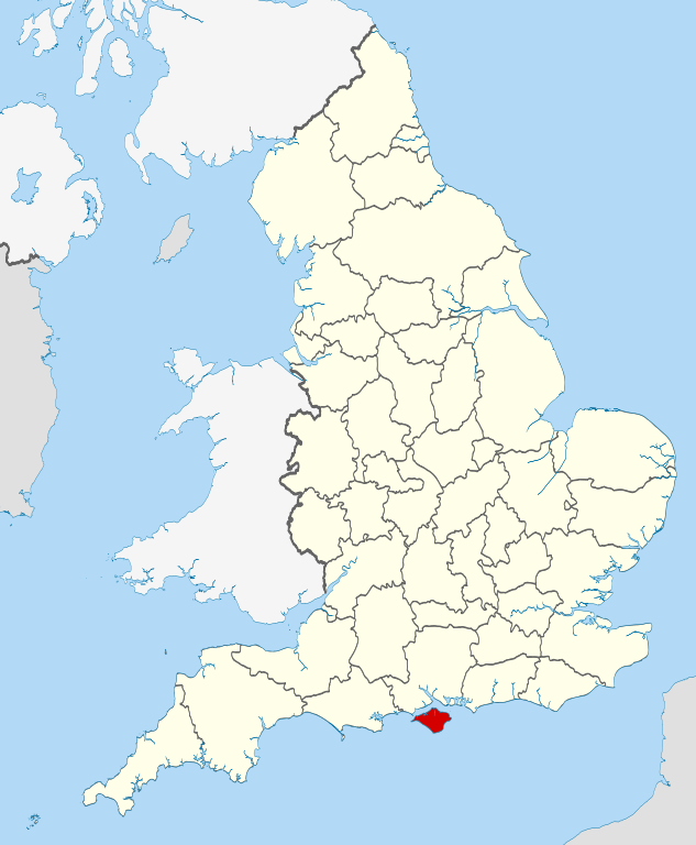
From Wikipedia, the free encyclopedia
Isle of Wight City and Town Maps
A
B
C
E
F
G
H
K
L
M
N
O
P
R
S
T
U
V
W
Isle of Wight Maps — Interactive Map, Street View, Weather & News
This page provides an interactive Google map of Isle of Wight, England with Street View, satellite and terrain views, alongside links to detailed street maps for cities, towns, villages and hamlets across the county. Isle of Wight sits within the South East England region.
Every locality map page includes an embedded street and satellite map together with live weather where available — current conditions with hourly and 7-day outlooks powered by Open-Meteo. Local and world news feeds — including BBC News — keep pages current, and Wikipedia summaries provide additional local context.
The Search Maps button below the map opens OS Outdoor and the OS Explorer 1:25 000 sheets as base layers, with a labelled OS National Grid overlay, a distance and bearing tool, and a single-fix GPS readout giving your grid reference and latitude and longitude.
Location data is sourced from OS Open Names © Crown copyright and database rights 2024, Ordnance Survey, Open Government Licence v3.0, and verified by coordinates rather than name matching alone.