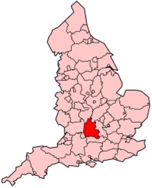
A large detailed map of Oxfordshire, England
Explore Oxfordshire with an interactive map featuring Street View, satellite and terrain views. Live weather, local news and location details for Oxfordshire — plus links to detailed street maps for cities, towns, villages and hamlets across the county.
Oxfordshire County Map
Map search is available for a limited number of queries per session to manage costs. Be specific — search precisely for best results.
| County Town | Oxford |
| Region | South East England |
| Country | England |
| Status | Ceremonial county |
| Area | 2,605 km² |
| Population | 694,000 |
| Latitude | 51.7590 |
| Longitude | -1.2956 |
| Cities & Towns | 596 |
| Locality Maps | Locality Maps |
About Oxfordshire
Undulating chalk downs, like the gentle swell of a sleeping giant, define Oxfordshire's terrain, punctuated by the sinuous silver threads of the River Thames and its tributaries, the Cherwell and the Evenlode. These waterways, carving their patient paths through the verdant countryside, lend a quiet, pastoral beauty to the county, a stark contrast to any imagined rugged coastlines. Gentle hills, such as Shotover, offer panoramic vistas of a landscape that feels both ancient and enduring, a subtle tapestry of arable fields and ancient woodlands that whispers of time immemorial.
Echoes of Roman legions still resonate faintly across the county, particularly around Alchester, a testament to early settlement, but it was the Anglo-Saxons who truly shaped its identity, establishing Oxford as a centre of learning and influence. The medieval period witnessed the ascendant power of its university, a crucible of intellectual ferment, while the English Civil War saw skirmishes and royalist encampments, a brief but violent interruption to its scholarly pursuits. Later centuries saw the consolidation of its agricultural prowess and the quiet growth of market towns, each adding a layer to its long and varied narrative.
Agriculture, long the bedrock of Oxfordshire's economy, continues to thrive, with the cultivation of cereals and the rearing of livestock forming a significant part of its rural character, particularly in the Vale of Evesham’s fertile fringes. Beyond the fields, however, the county has embraced modernity with a quiet determination, becoming a hub for scientific research and technological innovation, particularly in and around the university city of Oxford itself. This confluence of traditional farming and cutting-edge industry creates a unique economic dynamism, a balance of heritage and forward-thinking enterprise.
A certain cerebral air pervades Oxfordshire’s populace, a reflection of its world-renowned university, fostering an appreciation for the arts and intellectual discourse that permeates its towns and villages. Traditions, both academic and agrarian, are observed with a gentle reverence, a quiet adherence to the rhythms of the year and the scholarly calendar. Figures as diverse as J.R.R. Tolkien, whose imagination was deeply influenced by the local landscape, and the sharp wit of Margaret Thatcher, who studied law at Oxford, have left indelible marks on its cultural tapestry, contributing to a way of life that values both contemplation and accomplishment.
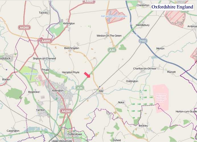
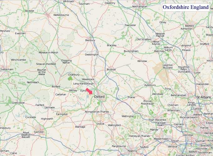
Oxfordshire Maps
"© OpenStreetMap contributors, CC BY-SA".
Districts of Oxfordshire County
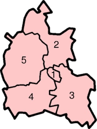
1 - Oxford
2 - Cherwell
3 - South Oxfordshire
4 - Vale of White Horse
5 - West Oxfordshire
From Wikipedia, the free encyclopedia
Oxfordshire City and Town Maps
A
B
C
D
E
F
G
H
J
K
L
M
N
O
P
R
S
T
U
W
Oxfordshire Maps — Interactive Map, Street View, Weather & News
This page provides an interactive Google map of Oxfordshire, England with Street View, satellite and terrain views, alongside links to detailed street maps for cities, towns, villages and hamlets across the county. Oxfordshire sits within the South East England region.
Every locality map page includes an embedded street and satellite map together with live weather where available — current conditions with hourly and 7-day outlooks powered by Open-Meteo. Local and world news feeds — including BBC News — keep pages current, and Wikipedia summaries provide additional local context.
Location data is sourced from OS Open Names © Crown copyright and database rights 2024, Ordnance Survey, Open Government Licence v3.0, and verified by coordinates rather than name matching alone.