Maps of West Midlands England
Home > Maps of England > West Midlands Maps
Welcome to our West Midlands map page. The map of West Midlands England that is located below is provided by Google Maps. You can "grab" the electronic map and move it around to re-center the map. You can change between standard map view and satellite map view by clicking the small square on the bottom left-hand corner of the map. Satellite map view utilises orbiting satellite and / or aerial high-resolution photography to display images of the map location to street level detail (really quite amazing). Standard map view shows a traditional street map (also known as a road map). You can use the zoom buttons on the bottom right-hand side of the map to zoom in or out to street level detail. We have digital online maps for most towns and cities on the Maps of England page. We also have a good collection of old school printable maps on the Maps of England page.
A map of West Midlands, England
West Midlands Maps
I hope you like the West Midlands County, England street map / road map situated above.
If you like our website, please consider adding a link to the site. These links help to build website traffic and they are considered a vote of confidence for a site.
West Midlands
The West Midlands is one of nine official regions of England at the first level of NUTS for statistical purposes. It covers the western half of the area traditionally known as the Midlands. The region consists of the counties of Herefordshire, Shropshire, Staffordshire, Warwickshire, West Midlands and Worcestershire. The largest city in the region is Birmingham.
The region is geographically diverse, from the urban central areas of the conurbation to the rural western counties of Shropshire and Herefordshire which border Wales. The longest river in the UK, the River Severn, traverses the region southeastwards, flowing through the county towns of Shrewsbury and Worcester, and the Ironbridge Gorge, a UNESCO World Heritage Site. Staffordshire is home to the industrialised Potteries conurbation, including the city of Stoke-on-Trent, and the Staffordshire Moorlands area, which borders the southeastern Peak District National Park near Leek. The region also encompasses five Areas of Outstanding Natural Beauty, the Wye Valley, Shropshire Hills, Cannock Chase, Malvern Hills, and parts of the Cotswolds. Warwickshire is home to the towns of Stratford upon Avon, birthplace of writer William Shakespeare, Rugby, the birthplace of Rugby football and Nuneaton, birthplace to author George Eliot.
From Wikipedia, the free encyclopedia
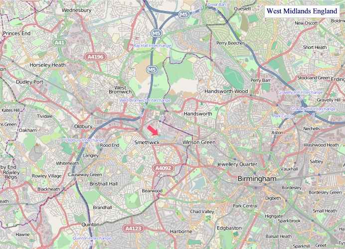
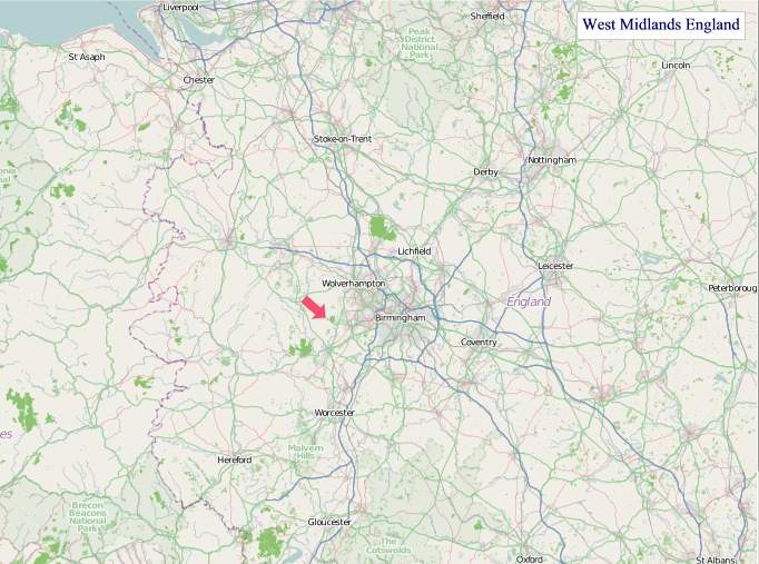
"© OpenStreetMap contributors, CC BY-SA".
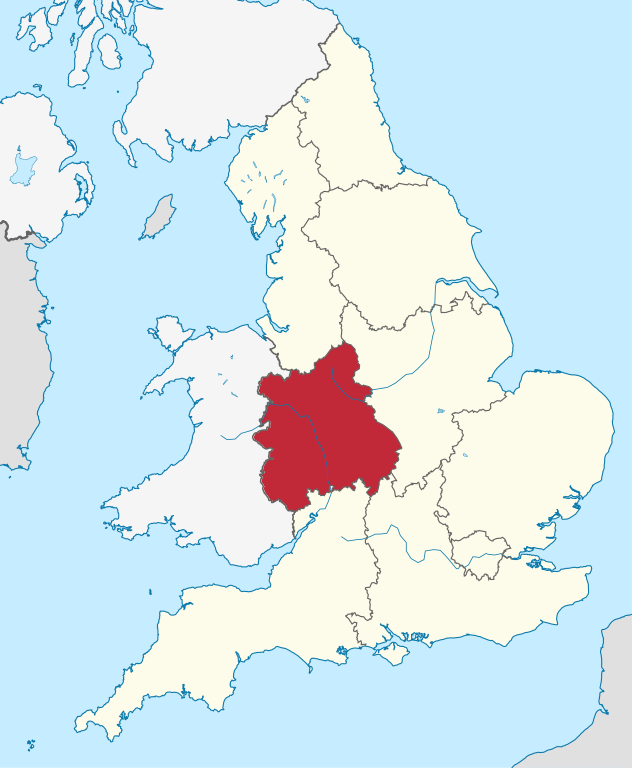
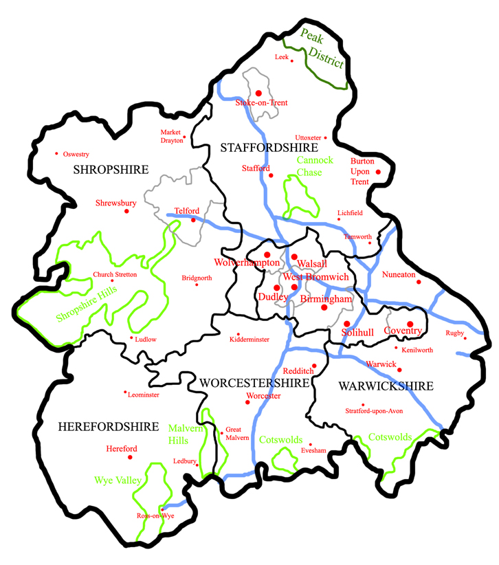
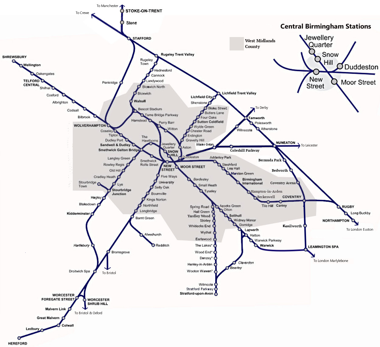
West Midlands consists of the following administrative subdivisions:
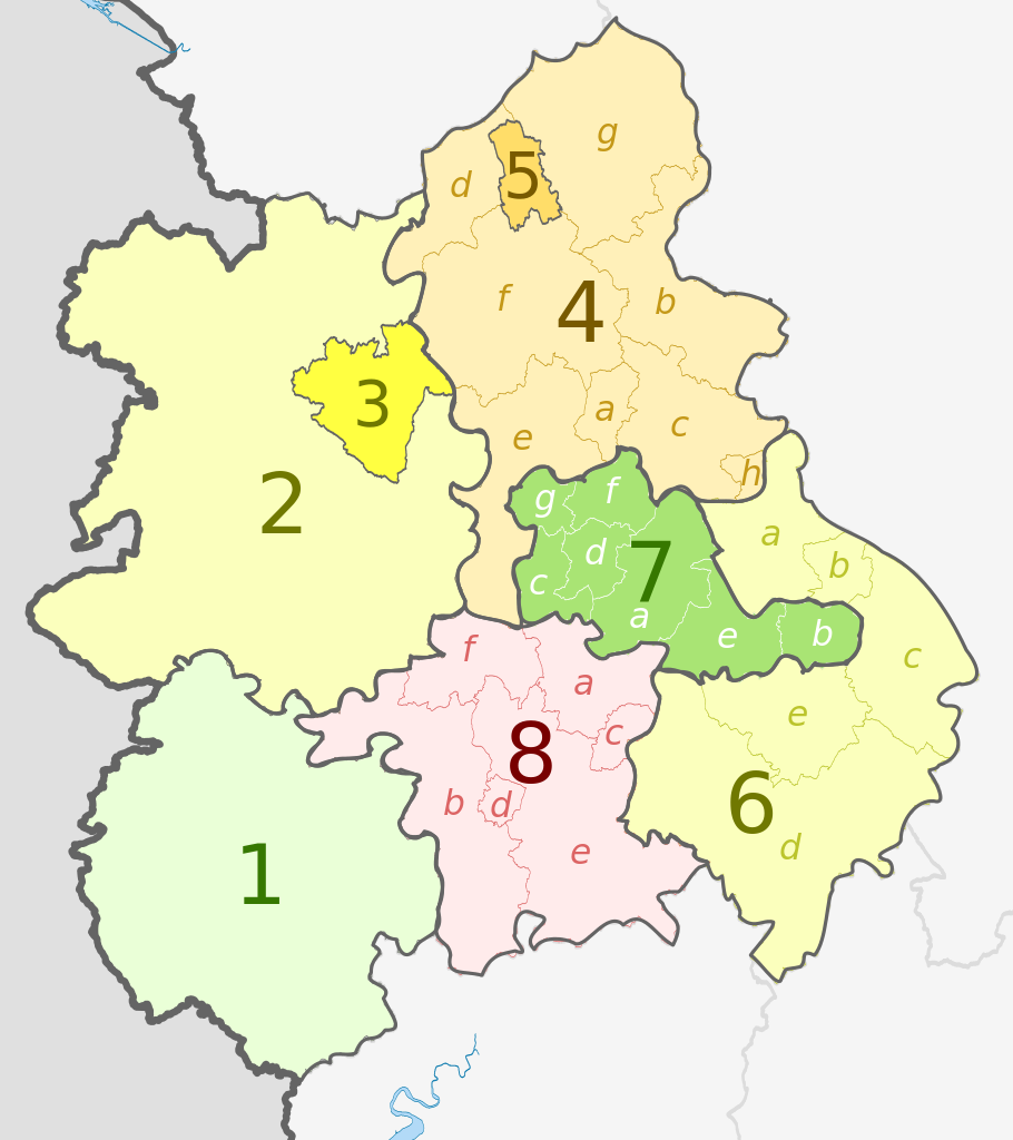
- 1. Herefordshire U.A. (Unitary Authority)
- Shropshire
- 2. Shropshire U.A.
- 3. Telford and Wrekin U.A.
- Staffordshire
- 4. Staffordshire
- a) Cannock Chase,
- b) East Staffordshire,
- c) Lichfield,
- d) Newcastle-under-Lyme,
- e) South Staffordshire,
- f) Stafford,
- g) Staffordshire Moorlands,
- h) Tamworth
- 5. Stoke-on-Trent U.A.
- 6. Warwickshire
- a) North Warwickshire,
- b) Nuneaton and Bedworth,
- c) Rugby,
- d) Stratford-on-Avon,
- e) Warwick
- 7. West Midlands
- a) Birmingham,
- b) Coventry,
- c) Dudley,
- d) Sandwell,
- e) Solihull,
- f) Walsall,
- g) Wolverhampton
- 8. Worcestershire
- a) Bromsgrove,
- b) Malvern Hills,
- c) Redditch,
- d) Worcester,
- e) Wychavon,
- f) Wyre Forest
From Wikipedia, the free encyclopedia
Music


