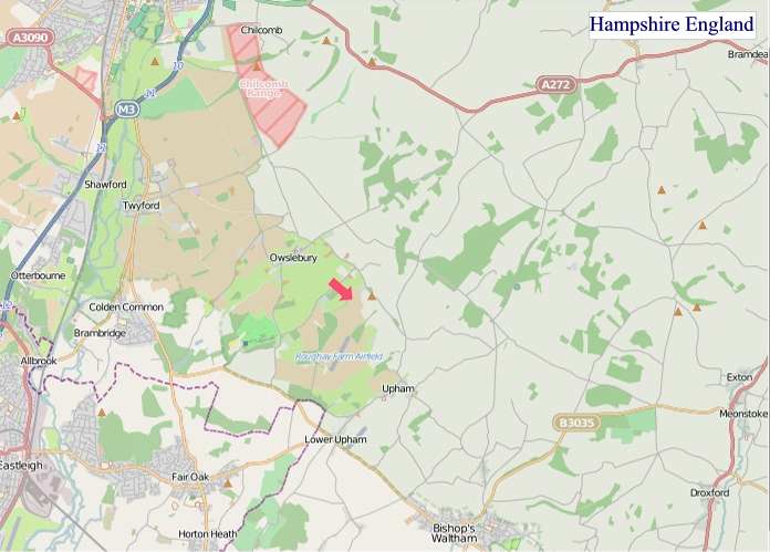
A large detailed map of Hampshire, England
Explore Hampshire with an interactive map featuring Street View, satellite and terrain views. Live weather, local news and location details for Hampshire — plus links to detailed street maps for cities, towns, villages and hamlets across the county.
Hampshire County Map
Map search is available for a limited number of queries per session to manage costs. Be specific — search precisely for best results.
| County Town | Winchester |
| Region | South East England |
| Country | England |
| Status | Ceremonial county |
| Area | 3,769 km² |
| Population | 1,865,000 |
| Latitude | 51.0417 |
| Longitude | -1.2810 |
| Cities & Towns | 1,061 |
| Locality Maps | Locality Maps |
About Hampshire
Hampshire unfolds a varied tapestry of earth and water, its terrain gracefully undulating from the chalky downs of the south to the ancient woodlands of the north. The River Test, a jewel of chalk streams, meanders through verdant valleys, whilst the Testwood marshes guard the Solent's intricate coastline, a gateway to the Isle of Wight. Gentle hills, like those around Selborne, offer sweeping vistas, their slopes carpeted in wildflowers during summer's bloom. This natural character, both serene and subtly dramatic, imbues the county with a timeless charm.
Centuries of human endeavour have etched themselves upon Hampshire's soil, a palimpsest of its storied past. Roman roads, like the ancientquèsting Stane Street, still whisper of legions marching towards Portchester Castle, a formidable Norman sentinel guarding the harbour. Winchester, its former capital, echoes with the glories of Alfred the Great and the grandeur of its cathedral, a testament to Saxon and medieval might. The county also witnessed the departure of pilgrims from Southampton for the New World, a poignant reminder of its maritime destiny.
Prosperity has long been fostered within Hampshire's borders, its economy a blend of enduring traditions and forward-looking innovation. Agriculture remains a vital force, with fertile lands yielding abundant crops and supporting thriving livestock industries, particularly around the market towns of Andover and Basingstoke. Manufacturing prowess is evident in the defence sector, with naval dockyards at Portsmouth forming a cornerstone of national security. Modern enterprises, too, flourish, contributing to a dynamic and resilient economic landscape.
The spirit of Hampshire resides in its people, a community marked by a quiet resilience and a deep connection to their heritage. Their way of life is shaped by the rhythm of the seasons and the proximity to both countryside and coast, fostering a love for outdoor pursuits and local traditions. The literary echoes of Jane Austen, who resided in Chawton, still resonate, whilst the artistic endeavours of contemporary sculptors and painters add vibrant strokes to the county's cultural palette. A strong sense of place and neighbourly fellowship defines this enduring corner of England.
Hampshire Maps
"© OpenStreetMap contributors, CC BY-SA".
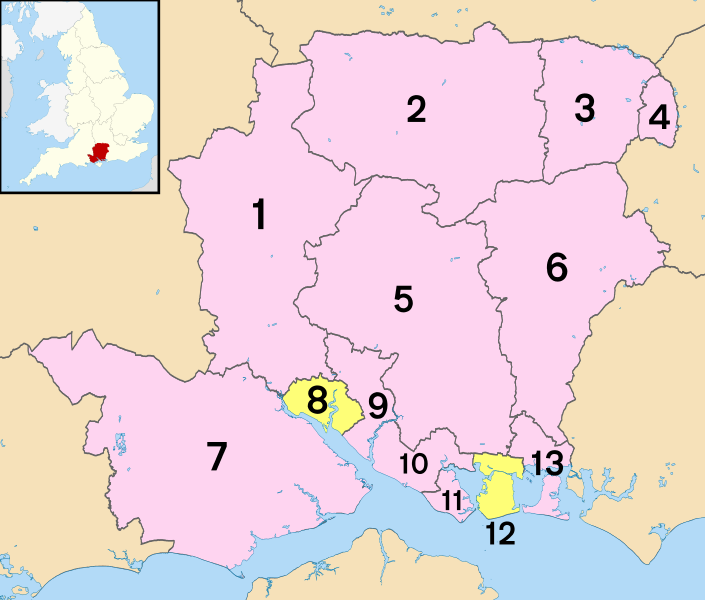
Districts of Hampshire
1 - Test Valley
2 - Basingstoke and Deane
3 - Hart
4 - Rushmoor
5 - Winchester
6 - East Hampshire
7 - New Forest
8 - Southampton (unitary)
9 - Eastleigh
10 - Fareham
11 - Gosport
12 - Portsmouth (unitary)
13 - Havant
From Wikipedia, the free encyclopedia
Hampshire City and Town Maps
A
B
C
D
E
F
G
H
I
K
L
M
N
O
P
Q
R
S
T
U
V
W
Y
Hampshire Maps — Interactive Map, Street View, Weather & News
This page provides an interactive Google map of Hampshire, England with Street View, satellite and terrain views, alongside links to detailed street maps for cities, towns, villages and hamlets across the county. Hampshire sits within the South East England region.
Every locality map page includes an embedded street and satellite map together with live weather where available — current conditions with hourly and 7-day outlooks powered by Open-Meteo. Local and world news feeds — including BBC News — keep pages current, and Wikipedia summaries provide additional local context.
Location data is sourced from OS Open Names © Crown copyright and database rights 2024, Ordnance Survey, Open Government Licence v3.0, and verified by coordinates rather than name matching alone.