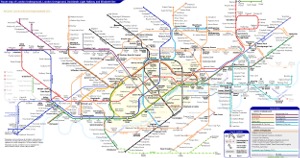
London Underground Tube Map
Hammersmith and City Line
Home > Maps of England > Hammersmith and City Line Map
Explore London City with an interactive map featuring address search, nearby places, live weather, Street View and detailed location information. Search for locations, restaurants, hotels and attractions while viewing satellite, terrain and road map layers across London City, England. Designed for fast access during travel planning and emergencies, including storms, flooding, severe weather and power outages where reliable map access is essential.
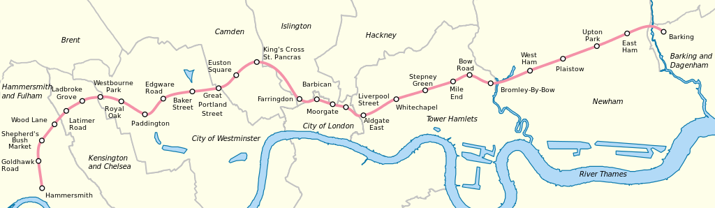
The Hammersmith & City line is a London Underground line that runs between Hammersmith in west London and Barking in east London. Coloured pink on the Tube map, it serves 29 stations over 15.8 miles (25.5 km). Between Farringdon and Aldgate East it skirts the City of London, the capital's financial heart, hence the line's name. Its tunnels are just below the surface and are a similar size to those on British main lines. Most of the track and all stations are shared with either the District, Circle or Metropolitan lines, the other parts of London Underground's sub-surface railway, and over 114 million passenger journeys are made each year on the Hammersmith & City and Circle lines.
In 1863, the Metropolitan Railway began the world's first underground railway service between Paddington and Farringdon with wooden carriages and steam locomotives. The following year, a railway west from Paddington to Hammersmith was opened and this soon became operated and owned jointly by the Metropolitan and Great Western Railway companies. The line was then extended to the east, in stages, reaching the East London Railway in 1884. The line was electrified in 1906, and, in 1936, after the Metropolitan Railway had been absorbed by the London Passenger Transport Board, some Hammersmith & City line trains were extended over the former District Railway line to Barking. The Hammersmith & City route was shown on the Tube map as part of the Metropolitan line until 30 July 1990, when it was redesignated as a separate line.
The track and signalling systems have been upgraded, and the old six-car C69/C77 Stock trains were replaced by new S7 Stock trains from 2012 to 2014 in a programme to increase capacity by 65 per cent by 2019.
The line runs parallel to the Great Western Main Line between Paddington and Westbourne Park, and parallel to the London, Tilbury and Southend line between West Ham and Barking.
From Wikipedia, the free encyclopedia
This file is licensed under the Creative Commons Attribution-Share Alike 3.0 Unported license.
London Underground Overground DLR Crossrail Map