A large detailed map of South Yorkshire, England
Explore South Yorkshire with an interactive map featuring Street View, satellite and terrain views. Live weather, local news and location details for South Yorkshire — plus links to detailed street maps for cities, towns, villages and hamlets across the county.
South Yorkshire County Map
Map search is available for a limited number of queries per session to manage costs. Be specific — search precisely for best results.
| County Town | Sheffield |
| Region | Yorkshire and the Humber |
| Country | England |
| Status | Metropolitan county |
| Area | 1,552 km² |
| Population | 1,402,000 |
| Latitude | 53.4582 |
| Longitude | -1.3901 |
| Cities & Towns | 598 |
| Locality Maps | Locality Maps |
About South Yorkshire
Undulating ridges of the Pennine fringe descend into the broad, low-slung basin of the Don Valley, where the landscape shifts from rugged heather moorland to fertile, alluvial plains. Rivers like the Dearne and the Rother carve slow, purposeful paths through the limestone bedrock, feeding the arteries of a region defined by its geological patience. Great crags of millstone grit stand sentinel above industrialised hollows, their weathered faces reflecting a sky that is often bruised with the charcoal clouds of the north. Ancient woodlands cling to the steep slopes of Wentworth, providing a verdant contrast to the stark, architectural lines of the earth below. Nature here possesses a stubborn, reclaimed vitality, asserting itself through the wild grasses and birch thickets that have colonised old spoil heaps.
Roman legions once marched along the paved routes of Danum, establishing the foundations of Doncaster amidst the marshes of the river valley. Norman conquerors later imposed their will through the stone fortifications of Conisburgh, where the circular keep still looms over the river like a silent, grey ghost of feudal authority. Centuries of turmoil saw the rise of great aristocratic estates, their sprawling grounds masking the buried memories of monastic ruins and medieval manors. Industrial transformation arrived with the steam engine, tearing through the pastoral silence to forge a new identity rooted in the rapid expansion of the nineteenth century. Every brick and cobbled alleyway in Barnsley or Sheffield serves as a palimpsest, layering the grit of modern endeavour over the deeper, more ancient strata of the past.
Steel remains the enduring heartbeat of this territory, a testament to the transformative fire that once roared in the furnaces of Sheffield and Rotherham. Master craftsmen forged the gleaming blades and heavy armaments that travelled to the furthest reaches of the empire, earning the city its global reputation for metallurgical excellence. Agriculture persists upon the eastern fringes, where the soil is tilled with a quiet, persistent labour that honours the heritage of the rural worker. Glassworks and coal pits long dominated the horizon, their skeletal frames once marking the rhythm of a working week that dictated the lives of thousands. Modern enterprises now occupy the repurposed sites of former giants, blending the legacy of heavy manufacturing with the agile, digital ambitions of a new technological age.
People possess a character forged in the crucible of communal hardship, defined by a dry, resilient humour that deflects the sharpest northern winds. Traditions of brass bands and choral societies persist in the quiet corners of village life, echoing the collective spirit of men who once laboured deep beneath the crust of the earth. Figures such as Barry Hines captured this raw, authentic humanity, immortalising the struggle of the individual against the indifferent weight of the social machine. Arts and literature flourish in the shadow of the old mills, where the dialect retains a melodic, clipped cadence that speaks of pride and unspoken solidarity. Life here moves with a steady, unpretentious grace, honouring the hard-won dignity of those who built a world out of nothing but iron, coal, and sweat.
South Yorkshire Maps
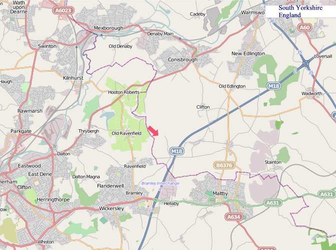
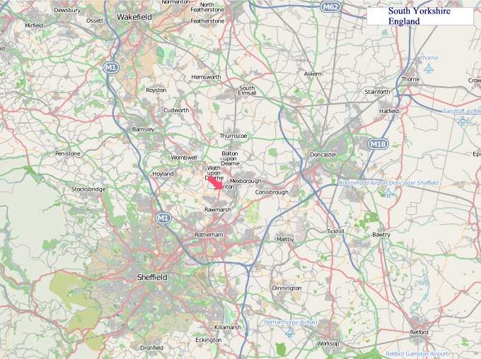
"© OpenStreetMap contributors, CC BY-SA".
Districts of South Yorkshire
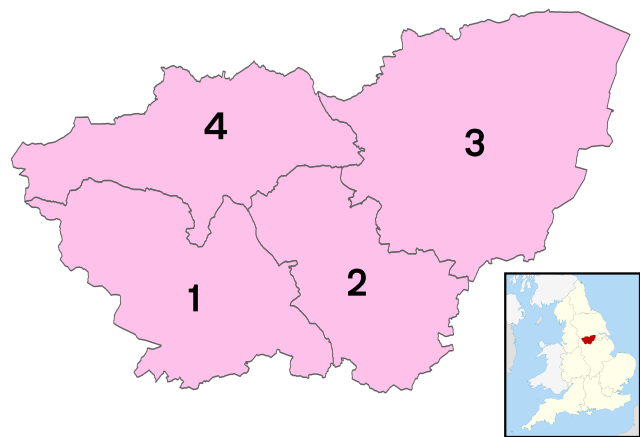
1 - City of Sheffield
2 - Rotherham
3 - Doncaster
4 - Barnsley
From Wikipedia, the free encyclopedia
South Yorkshire City and Town Maps
A
B
C
D
E
F
G
H
I
J
K
L
M
N
O
P
R
S
T
U
V
W
South Yorkshire Maps — Interactive Map, Street View, Weather & News
This page provides an interactive Google map of South Yorkshire, England with Street View, satellite and terrain views, alongside links to detailed street maps for cities, towns, villages and hamlets across the county. South Yorkshire sits within the Yorkshire and the Humber region.
Every locality map page includes an embedded street and satellite map together with live weather where available — current conditions with hourly and 7-day outlooks powered by Open-Meteo. Local and world news feeds — including BBC News — keep pages current, and Wikipedia summaries provide additional local context.
The Search Maps button below the map opens OS Outdoor and the OS Explorer 1:25 000 sheets as base layers, with a labelled OS National Grid overlay, a distance and bearing tool, and a single-fix GPS readout giving your grid reference and latitude and longitude.
Location data is sourced from OS Open Names © Crown copyright and database rights 2024, Ordnance Survey, Open Government Licence v3.0, and verified by coordinates rather than name matching alone.