London Underground Tube Map
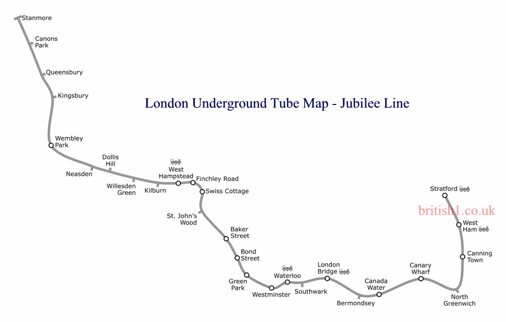
Jubilee Line
Home > Maps of England > Jubilee Line Map
Explore London City with an interactive map featuring address search, nearby places, live weather, Street View and detailed location information. Search for locations, restaurants, hotels and attractions while viewing satellite, terrain and road map layers across London City, England. Designed for fast access during travel planning and emergencies, including storms, flooding, severe weather and power outages where reliable map access is essential.
The Jubilee line is a line on the London Underground ("the Tube"), in the United Kingdom. It was built in two major sections - initially to Charing Cross in Central London, and later extended in 1999 to Stratford in East London. The later stations are notable for their larger size and safety features (both being attempts to future-proof the line). Out of 27 stations served, 13 are below ground. Each platform is 130 metres long.
The Jubilee line is coloured silver/grey on the Tube map.
From Wikipedia, the free encyclopedia
This file is licensed under the Creative Commons Attribution-Share Alike 3.0 Unported license.
London Underground Overground DLR Crossrail Map