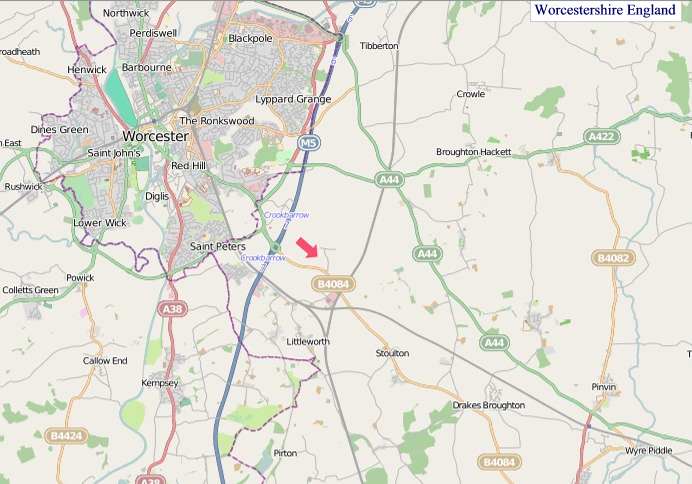
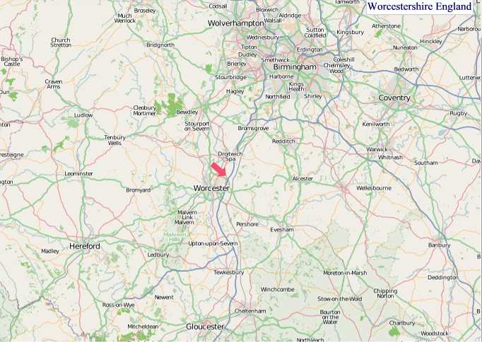
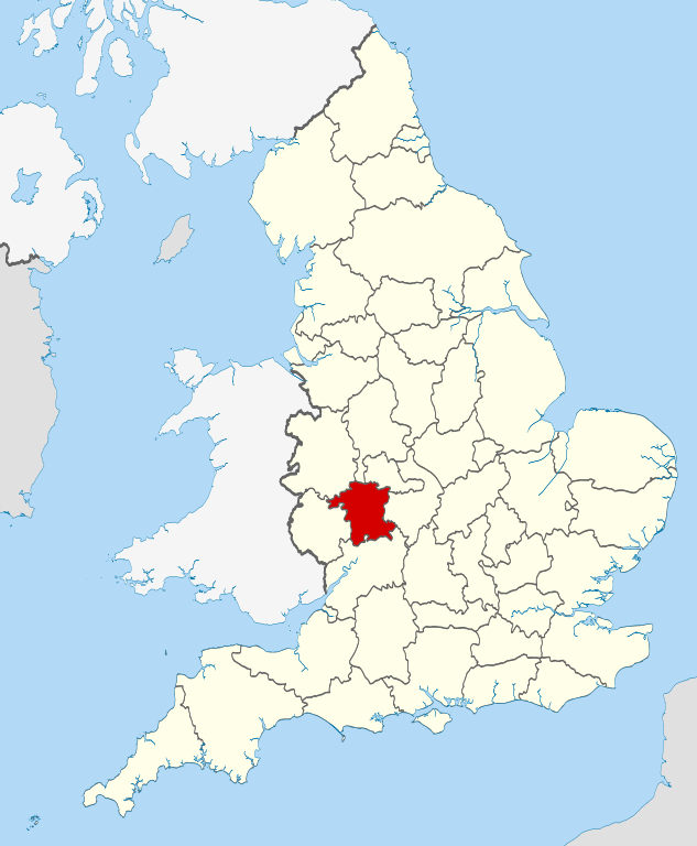
A large detailed map of Worcestershire, England
Explore Worcestershire with an interactive map featuring Street View, satellite and terrain views. Live weather, local news and location details for Worcestershire — plus links to detailed street maps for cities, towns, villages and hamlets across the county.
Worcestershire County Map
Map search is available for a limited number of queries per session to manage costs. Be specific — search precisely for best results.
| County Town | Worcester |
| Region | West Midlands |
| Country | England |
| Status | Ceremonial county |
| Area | 1,741 km² |
| Population | 602,000 |
| Latitude | 52.2311 |
| Longitude | -2.1757 |
| Cities & Towns | 676 |
| Locality Maps | Locality Maps |
About Worcestershire
Undulating softly like a slumbering giant, Worcestershire's landscape unfolds in a gentle tapestry of verdant pastures and ancient woodlands, bisected by the stately flow of the River Severn, its waters a mirror to the ever-changing skies. Beyond the broad plains, the Malvern Hills rise with a quiet dignity, their slopes cloaked in mist and heather, offering panoramic vistas that have inspired poets for centuries. This is a land where brooks meander lazily through hedgerows, and copses of oak and ash stand sentinel over timeless villages, a placid beauty that speaks of deep, enduring earth.
Echoes of Roman legions still whisper across the soil of Worcestershire, where settlements like the venerable city of Worcester itself bear witness to millennia of human endeavour. The Norman conquest left its mark in stone, evident in the robust fortifications and ecclesiastical architecture that punctuate the county's towns, while the tumultuous centuries of civil war saw this very land become a battleground for king and parliament, the legacy of which is etched into local lore. Later, the industrial revolution transformed parts of its character, yet the fundamental agrarian spirit persisted, a resilient thread woven through its long and varied chronicle.
Cultivating the fertile earth remains a cornerstone of Worcestershire's economic life, with fields yielding bountiful harvests of apples for cider, pears, and the quintessential Worcestershire sauce, a culinary icon that has travelled the globe. Beyond the bounty of the land, industry has found a steady footing, particularly in manufacturing sectors that have long specialised in areas such as ceramics and engineering, with Kidderminster once renowned for its carpet production. These enterprises, though evolving, continue to provide livelihoods and contribute to the county's quiet, industrious hum.
A certain unhurried grace defines the people of Worcestershire, their character often mirroring the gentle disposition of their surroundings, a blend of pragmatism and an appreciation for the subtler charms of life. Traditions, from the lively agricultural shows held under summer skies to the enduring practise of local festivals, are cherished with a quiet pride, fostering a strong sense of community. This is a place where the arts, though perhaps not as overtly flamboyant as in larger metropolises, thrive in local galleries and theatres, reflecting a deep-seated creative spirit and a contented way of living.
Worcestershire Maps
"© OpenStreetMap contributors, CC BY-SA".
Districts of Worcestershire
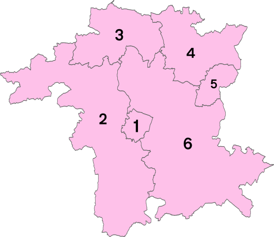
1 - Worcester
2 - Malvern Hills
3 - Wyre Forest
4 - Bromsgrove
5 - Redditch
6 - Wychavon
From Wikipedia, the free encyclopedia
Worcestershire City and Town Maps
A
B
C
D
E
F
G
H
I
K
L
M
N
O
P
R
S
T
U
V
W
Worcestershire Maps — Interactive Map, Street View, Weather & News
This page provides an interactive Google map of Worcestershire, England with Street View, satellite and terrain views, alongside links to detailed street maps for cities, towns, villages and hamlets across the county. Worcestershire sits within the West Midlands region.
Every locality map page includes an embedded street and satellite map together with live weather where available — current conditions with hourly and 7-day outlooks powered by Open-Meteo. Local and world news feeds — including BBC News — keep pages current, and Wikipedia summaries provide additional local context.
Location data is sourced from OS Open Names © Crown copyright and database rights 2024, Ordnance Survey, Open Government Licence v3.0, and verified by coordinates rather than name matching alone.