Maps of England
Home > Map of England
We have a dedicated domain name pointed at this page - ukmaps1.co.uk. So If you want fast UK maps use that url.
Welcome to our map page. The map of England that is located below is provided by Google Maps. You can "grab" the electronic map and move it around to re-center the map. You can change between standard map view and satellite map view by clicking the small square on the bottom left-hand corner of the map. Satellite map view utilises orbiting satellite and / or aerial high-resolution photography to display images of the map location to street level detail (really quite amazing). Standard map view shows a traditional street map (also known as a road map). You can use the zoom buttons on the bottom right-hand side of the map to zoom in or out to street level detail. We have digital online maps for most towns and cities on the Maps of England page. We also have a good collection of old school printable maps on the Maps of England page.
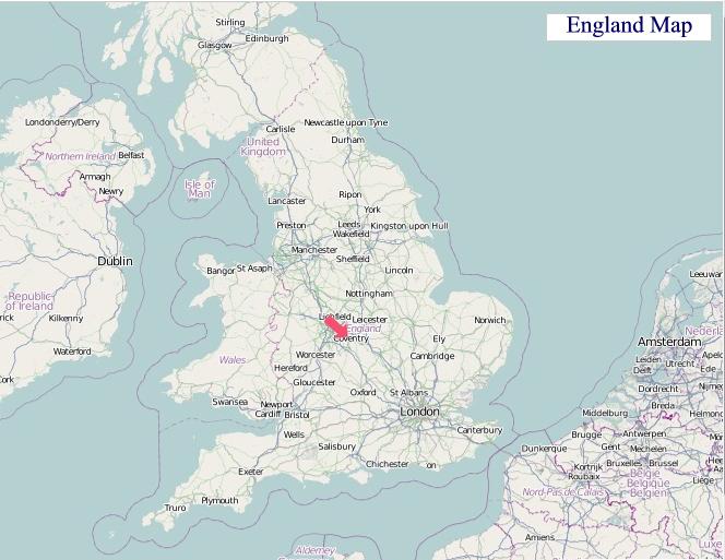
A Map of England
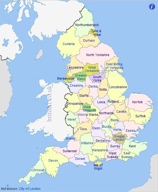
A large detailed UK Counties Map for England
From Wikipedia, the free encyclopedia
England County Maps
I hope you like the England street map / road map situated above.
If you like our website, please consider adding a link to the site. These links help to build website traffic and they are considered a vote of confidence for a site.
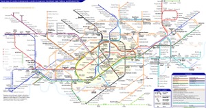
London Underground Tube Maps
London Underground Overground DLR Crossrail Map
London Underground Tube Map - Zone 1
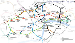
London Underground Tube Maps
Modern Maps of England
Historic Maps
Kingdoms and Tribes of England Circa AD 600
Map of England, United Kingdom
"© OpenStreetMap contributors, CC BY-SA".
Map of Britain - Map of Great Britain
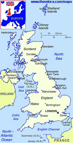
Maps courtesy of www.theodora.com/maps used with permission.


